Northern Ireland packs more paddling variety into its compact geography than almost any other region on the island. Within two hours of Belfast, you can choose between committing Atlantic sea kayaking on the Causeway Coast, tidal wildlife paddling on Strangford Lough, urban exploration on the River Lagan, or multi-day flatwater touring on Lough Erne. This guide covers each destination in full — what the conditions demand, what it costs, and exactly what you need to bring.
Whether you are crossing the border for a kayaking weekend or planning a longer Northern Ireland paddle tour, here is everything you need to know.
1. Why Northern Ireland is an Underrated Paddling Destination
Northern Ireland is one of the most underrated kayaking destinations on the island of Ireland, and the reasons why are straightforward: most Irish paddlers focus on the counties they know (Kerry, Galway, Donegal), and the cross-border element occasionally causes people to assume more complexity than actually exists.
In practice, crossing from the Republic into Northern Ireland is seamless for British and Irish citizens travelling under the Common Travel Area. There are no border controls, no passport checks, no delays. If you hold a different nationality, UK immigration rules still apply to you, including the UK’s Electronic Travel Authorisation (ETA) where required, even though there is no checkpoint at the land border to check it. Confirm your own requirements before you travel. The other practical differences you encounter as a visiting paddler from the Republic are that the currency switches to Pound Sterling (GBP), emergency services can be reached by dialling 999 or 112 (both work), and speed limits are in miles per hour.
The paddling itself is genuinely world-class. The Giant’s Causeway itself, together with a defined stretch of coast around it, forms the Giant’s Causeway and Causeway Coast UNESCO World Heritage Site. The wider Causeway Coast beyond that boundary isn’t itself a World Heritage property, but the geological drama of its basalt columns, sea arches, and cave systems is unlike anything in the Republic. Strangford Lough is one of the finest wildlife paddling destinations in Western Europe. The Fermanagh Lakelands — Upper and Lower Lough Erne — are one of Ireland’s best-kept secrets for multi-day kayak camping. All of it is within easy reach.
2. Who Should Paddle in Northern Ireland?
Northern Ireland serves every paddling skill level, but the key is matching the right location to your experience.
- Absolute Beginners (Level 1): The River Lagan through Belfast and the sheltered bays of Strangford Lough (away from the Narrows) are ideal. The water is calm, commercial operators provide all gear, and tidal currents are manageable.
- Novice to Intermediate Paddlers (Level 2–3): The main body of Strangford Lough, the sheltered inlets of Carlingford Lough, and the inland Erne waterways are excellent. These environments require competent paddling but are fundamentally forgiving.
- Advanced Sea Kayakers (Level 4+): The Causeway Coast from Ballintoy to Ballycastle and the tidal races of the Strangford Narrows are the destinations. The North Channel (between Ireland and Scotland) generates some of the most technically demanding paddling conditions in Ireland.
3. When to Go: Weather and Tides
The Causeway Coast Season
The most favourable months for the Causeway Coast are similar to the west of Ireland: May through September, when high-pressure weather systems are more frequent. Even so, any month can bring a clean weather window, and any summer week can bring a swell that keeps you off the water. Prevailing south-westerly winds are partially blocked by the land mass of County Antrim for the eastern Causeway Coast, making it slightly more sheltered than the west of Ireland in typical conditions.
However, the North Channel between Ireland and Scotland is a notoriously powerful body of water. When Atlantic depressions track north of Scotland, they generate huge swells that arrive on the Causeway Coast from the north-west — the worst possible direction for this coastline. Always check the Met Office Northern Ireland Marine Forecast (the equivalent of Met Éireann for Northern Ireland) before any coastal paddle.
Strangford Lough: Tidal Over Seasonal
Strangford Lough is paddleable in reasonable weather year-round. The key variable is not season but tide. The Strangford Narrows — the narrow channel connecting the lough to the Irish Sea — generates tidal currents of up to around 7.5 knots at springs, among the fastest tidal flows in Europe. Inside the main body of the lough, conditions are usually calmer, though wind direction and fetch still matter. But the Narrows is a different environment again and must be treated with respect.
| Beaufort Force | Wind Speed (knots) | Sea State | Recommendation for NI Paddlers |
|---|---|---|---|
| Force 1–2 | 1 – 6 knots | Calm, glassy | Good conditions for most routes, but check wind direction against your coastline and the forecast swell before you commit. Calm at the launch doesn’t guarantee calm further round. |
| Force 3 | 7 – 10 knots | Gentle ripples | Causeway Coast becomes route-dependent: workable for intermediates with a guide on a sheltered heading, more exposed if the wind is onshore. Strangford’s main body is usually comfortable, but check the Narrows tide state separately. |
| Force 4 | 11 – 16 knots | Moderate chop | Causeway Coast is for advanced paddlers with escape routes planned. Strangford’s interior is often still workable away from the Narrows, but exposure and swell direction still decide it. |
| Force 5+ | 17+ knots | Heavy seas, whitecaps | Coastal paddling isn’t advisable at this strength. Even sheltered loughs and rivers can turn choppy in exposed reaches, so check your specific launch before deciding. |
4. The 5 Best Places to Kayak in Northern Ireland
1. The Causeway Coast (Ballintoy to Ballycastle)
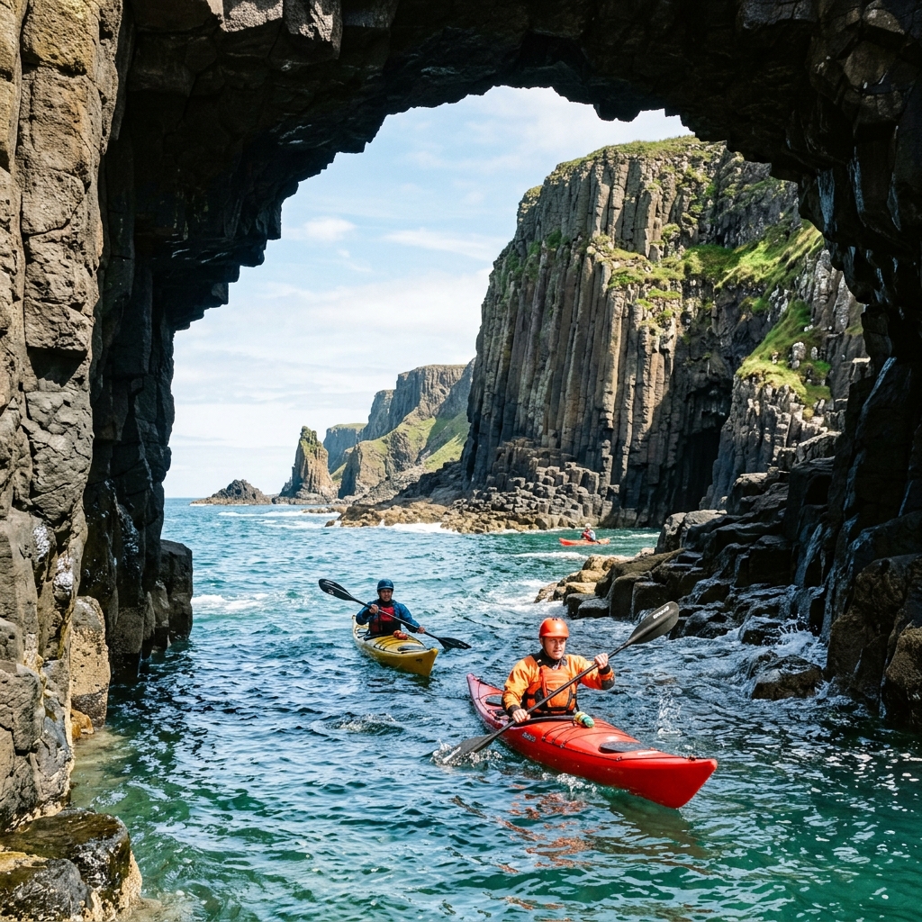
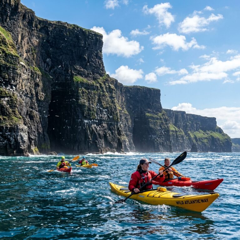
The Causeway Coast between Ballintoy Harbour and Ballycastle is Northern Ireland’s flagship sea kayaking destination, and for good reason. The geology here is extraordinary — you are paddling through the remnants of a 60-million-year-old volcanic eruption. The hexagonal basalt columns that make the Giant’s Causeway famous extend for kilometres east and west, and many of the most spectacular formations are completely inaccessible except from the water.
Launching from Ballintoy Harbour — a small, sheltered stone pier set into a dramatic cliff — gives you immediate access to the most dramatic section of the coast. Within a short paddle east, you can explore sea arches, zawn cuts (deep narrow inlets), and sea caves carved into the basalt. The ruins of Dunseverick Castle perch on the cliff above you as you pass. Looking west, the island of Carrick-a-Rede and its famous rope bridge are visible from the water at a perspective unavailable to the thousands of tourists on the land above.
Continuing east from Ballintoy, the coastline opens out toward the Causeway itself — the main UNESCO World Heritage Site. Viewing the stepped basalt columns from a kayak floating 5 metres from their base is a genuinely singular experience.
The commitment: Like the Cliffs of Moher in Clare, this coastline offers limited emergency landing options. You need sealed bulkheads, a spray deck, a VHF radio tuned to Channel 16 (Belfast Coastguard), and advanced sea kayaking qualifications from Paddle Northern Ireland (the governing body formerly known as CANI), or Canoeing Ireland Level 4 or equivalent. Guided tours from qualified operators are the appropriate choice for anyone below advanced level.
2. Strangford Lough
Strangford Lough is the largest sea inlet in the UK and Ireland — covering around 150 km² and containing over 70 small islands (known locally as “pladdies”) and extraordinary tidal diversity. It is a designated Area of Outstanding Natural Beauty (AONB), a Marine Conservation Zone, and a Ramsar Wetland of International Importance.
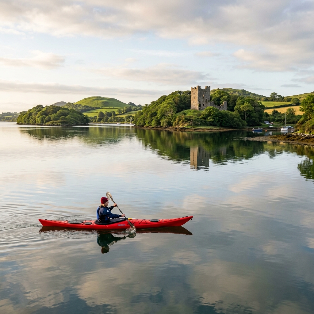
For wildlife, Strangford Lough is arguably the best paddling destination on the island of Ireland. Large colonies of common and grey seals haul out on the pladdies year-round. In winter, up to 90% of the world population of light-bellied brent geese arrive from Arctic Canada to overwinter here, according to WWT — tens of thousands of birds visible from your kayak. Porpoises and basking sharks pass through the Narrows in summer.
Launch points: The main organised launch areas are at Portaferry (at the Narrows), Castle Ward (operated by the National Trust), and Strangford village. The Castle Ward slipway is the most popular starting point for recreational paddling in the main lough — sheltered, accessible, and offering a range of island-hopping routes without approaching the Narrows.
The Narrows: If you are an experienced paddler specifically interested in the Strangford Narrows tidal race (a genuine white-water-grade tidal environment), you must time it to the slack water precisely. Peak flow reaches around 7.5 knots at springs — faster than most paddlers can maintain against it. Portaferry RNLI’s inshore lifeboat covers the Narrows and responds to incidents here.
3. Belfast and the River Lagan
For urban exploration, Belfast offers something unique in Ireland. The River Lagan runs through the centre of the city, and the lower reaches pass through the Titanic Quarter — the former shipyard where RMS Titanic and her sister ships were built.
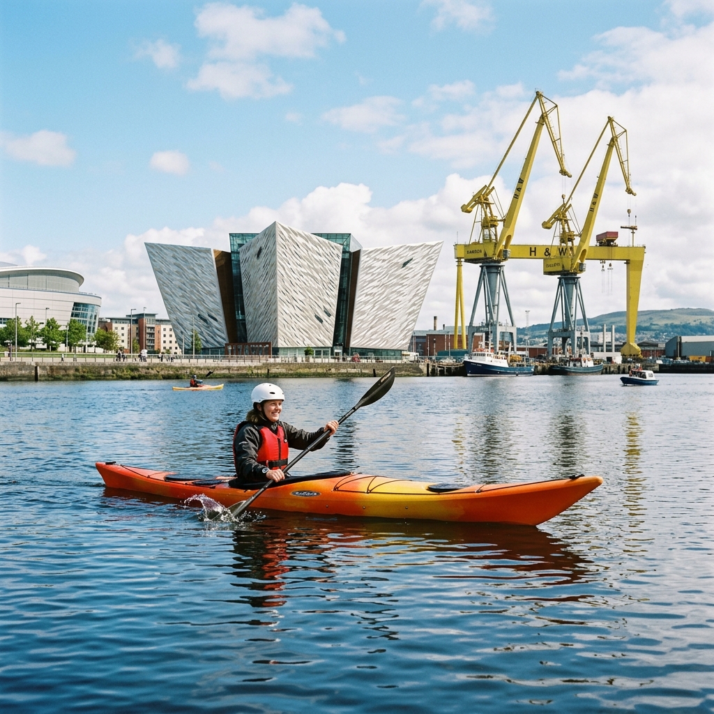
Paddling the Lagan, the two iconic yellow Harland & Wolff cranes — Samson (106 metres) and Goliath (96 metres) — dominate the skyline above you. The Titanic Belfast museum, its angular aluminium-clad form echoing the shape of a ship’s prow, sits directly on the waterfront. There is a real maritime history to absorb as you paddle.
The lower Lagan is tidal, and its pace on any given day depends on the state of the tide, the weir releases, and how much harbour traffic is moving through. Commercial operators plan their trips around this rather than treating it as constant. Guided tours run from the Donegall Quay area, timed to the tide and providing all necessary safety equipment, and access to some stretches is subject to the harbour authority’s rules. This is Belfast’s most accessible paddling experience for visitors without their own equipment, and a guided trip on the flat water suits complete beginners well.
- Skill Level: Absolute Beginner (guided) or Novice (self-guided).
- Launch: Donegall Quay or Titanic Quarter.
4. Upper and Lower Lough Erne (Fermanagh)
The Erne Lakelands in County Fermanagh are one of Ireland’s great secrets for multi-day kayak camping. Upper and Lower Lough Erne together form a network of interconnected navigable water (the signed Lough Erne Canoe Trail alone runs to around 68 km end to end), stretching from the border with the Republic near Belleek northward to Enniskillen and beyond.
The waterway is managed by Waterways Ireland — the cross-border body that also manages canals and rivers in the Republic — so the launch points, lock infrastructure, and navigation guides are of a high standard. Multiple islands in Lough Erne are accessible only by boat, several of which have camping areas and historical remains of early Christian monasteries.
- Skill Level: Beginner to Intermediate.
- Best For: Multi-day touring and kayak camping.
- Trip Length: A full through-paddle of Upper and Lower Lough Erne typically takes several days, depending on your pace and how many islands you detour to explore.
5. Carlingford Lough
Carlingford Lough is a glacial sea lough on the border between Louth (Republic) and Down (Northern Ireland). The lough is sheltered by the Cooley Mountains on the south shore and the Mourne Mountains on the north, creating a protected paddling environment with genuine mountain scenery.
Launching from Rostrevor or Warrenpoint on the Northern Ireland shore gives access to the tidal channels and the sheltered middle section of the lough. The Greenore–Greencastle ferry, previously a popular way to reach the southern shore, is not running for the 2026 season — check the operator’s current schedule before planning a route around it.
5. How to Plan a Strangford Lough Island-Hopping Route
The Strangford Lough island-hopping route from Castle Ward is the most popular guided and self-guided paddle on the lough. Here is how to plan it properly.
- Check the Tide: Download a tidal prediction for Strangford before you go. Timing at Castle Ward is far gentler than at the Narrows, but the direction and strength of the flood and ebb still shape which way is easiest to paddle out and back. Get current, route-specific tidal advice from the National Trust at Castle Ward or a local guide rather than relying on a fixed rule of thumb. The Castle Ward area is far enough from the Narrows that you will not experience the full tidal race, but the current still influences your direction.
- Pick Your Islands: The most popular route from Castle Ward heads east toward Pig Island and Inch Island, both within 2–3 km of the shore — manageable round trips for most paddlers. Seals haul out on several of the pladdies in this direction; view them from the water and do not land, in line with National Trust guidance for the lough’s seal and seabird islands.
- Approaching Seals: Seals on Strangford are legally protected, and the National Trust asks paddlers not to land on the islands they use as haul-outs. Keep well back and let the seals set the distance. If animals start lifting their heads, shuffling toward the water, or entering the water together, you are already too close and should back off. A spooked seal colony that rushes into the water simultaneously creates a significant wash and surge around the rocks. Do not approach closer, however tempting the photo opportunity.
- VHF Protocol: Always have a VHF radio on Channel 16 (Belfast Coastguard) for any Strangford Lough paddle. Leave your float plan (launch point, route, and expected return time) with a responsible contact ashore, and follow Belfast Coastguard’s current safety advice for the area.
6. What Can Go Wrong: The Specific Risks in Northern Ireland
- The Strangford Narrows: The single most significant risk for visiting paddlers in Northern Ireland. The current at peak flow cannot be paddled against by any recreational kayaker. If you are sucked into the Narrows at the wrong state of tide, you have a very serious problem. Never paddle the Narrows without specific tidal race training and a thorough understanding of the tidal predictions.
- North Channel Swell: The stretch of sea between Ballycastle and Rathlin Island is exposed to the North Channel — the same body of water that separates Ireland from Scotland at its narrowest point. Atlantic swells travelling around the top of Ireland arrive here from a completely different direction than along the west coast, catching paddlers off guard.
- Cold Water Throughout the Year: Northern Ireland’s coastal water is consistently cold — 7°C to 14°C depending on season. A wetsuit is strongly recommended from October through April, and many advanced sea paddlers wear a drysuit year-round. What you need depends on your route, how long you’d be in the water if things went wrong, and your own cold tolerance.
7. What to Avoid: Common Mistakes by Visiting Paddlers
- Confusing the Tidal Slack at Strangford: The Narrows does not have a conventional 6-hour slack window. The tidal flow runs extremely fast and the slack is brief — often only 20–30 minutes in either direction at the transition. Many visitors misjudge the timing. If you are unsure, paddle the main body of the lough only and leave the Narrows to people with specialist local knowledge.
- Using GBP/Republic Currency Mix-Up: Guided tours in Northern Ireland operate in Pound Sterling (GBP), not euros. While some operators accept card payments in either currency, always confirm the pricing currency when booking. Cash ATMs in Northern Ireland dispense GBP.
- Assuming the Emergency Number Changes: Both 999 and 112 work in Northern Ireland, the same as in the Republic. There is nothing new to remember once you cross the border. The responding Coastguard station for the Causeway Coast is Belfast Coastguard; for Strangford, it is also Belfast Coastguard. For Carlingford Lough, coverage overlaps between Dublin Coastguard and Belfast Coastguard.
8. Financial Breakdown: The Cost of Kayaking in Northern Ireland
Tours and rentals in Northern Ireland are priced in GBP.
Bringing your own kayak dramatically reduces the cost. The lough and river launch points maintained by Waterways Ireland and the National Trust are generally free to use or have minimal car park charges. The Fermanagh Lakelands are cost-effective for self-guided multi-day paddling too — Share Discovery Village runs a bookable bothy and campsite for canoeists and kayakers on Trannish Island, and several other islands are privately owned or farmed, so check who owns the ground and get permission before pitching a tent anywhere else on the lough.
9. What Comes Next: Building on a Northern Ireland Paddle Trip
If the Causeway Coast has given you an appetite for serious Atlantic sea kayaking, the next natural step is the Donegal coastline to the south-west — arguably Ireland’s most committing and beautiful sea kayaking ground. The stretch from Malin Head south through the Rosses and into Sligo is genuinely expedition-level paddling.
If the Fermanagh Lakelands have sparked an interest in multi-day kayak touring, the River Erne connects southward toward the Shannon via a network of rivers and lakes that spans the centre of Ireland. A full Shannon-to-Erne paddle, from Limerick all the way to Belleek, is one of Ireland’s great inland waterway journeys.
Frequently Asked Questions
Is the Causeway Coast safe for beginners? Not independently. The Causeway Coast is exposed to the Atlantic Ocean and the powerful currents of the North Channel. For beginners, the only sensible option is a guided tour with a qualified operator who makes the weather and safety assessment on your behalf. Do not attempt to self-guide this route without advanced sea kayaking qualifications from Paddle Northern Ireland (formerly CANI), or Canoeing Ireland Level 4 or equivalent.
How dangerous is the Strangford Narrows? At peak tidal flow, the Narrows runs at around 7.5 knots at springs, among the fastest tidal currents in Ireland and Western Europe. It is not paddleable against the flow by any recreational kayaker. Timing your crossing to the tidal slack (which lasts only 20–30 minutes) is essential. Paddle the main body of the lough away from the Narrows unless you have specific tidal race training.
Do I need a passport to kayak in Northern Ireland from the Republic? Not if you’re a British or Irish citizen. Under the Common Travel Area there is no border control and no passport required, and the border is invisible on most roads. If you hold a different nationality, UK immigration rules still apply, including the UK’s Electronic Travel Authorisation (ETA) where it’s required, so check your own situation before crossing.
What currency do I need in Northern Ireland? Pound Sterling (GBP). Most larger operators and shops accept credit cards, but if you are planning to buy food, pay for car parks, or use smaller local operators, bring GBP. ATMs in Northern Ireland dispense GBP, not euros.
Can I kayak on Lough Neagh? Yes. Lough Neagh is the largest freshwater lake in the British Isles, and its shores are accessible from multiple points. However, it is a very large, exposed body of water and generates significant wave action in strong winds. It is best approached by kayakers with at least intermediate-level skills and a touring kayak rather than a sit-on-top.
Are there kayaking clubs in Northern Ireland? Yes. Paddle Northern Ireland (formerly the Canoe Association of Northern Ireland, CANI) — the Northern Ireland equivalent of Canoeing Ireland — maintains a directory of affiliated clubs across the region, from Bangor to Enniskillen. Joining a Paddle Northern Ireland-affiliated club is the safest and most cost-effective way to build skills on the water.

No comments yet on this guide.
Be the first to share your experience — conditions, access, hazards, or anything a future paddler should know.
Login to join the discussion