There are four completely different kinds of water inside a forty-minute drive of Eyre Square, and Galway is one of the few places in Ireland where you can paddle all of them in a single week. There is a sheltered sea bay at Rusheen where a first-timer can hire a boat and paddle it under the operator’s own rules, weather and tide allowing. There is a short, violent river running straight through the middle of the city. There is a freshwater lake so large it holds an estimated three hundred and sixty-five islands. And there is the open Atlantic coast of Connemara, with a genuine fjord at its northern edge. No other county pillar on this site covers a spread that wide, and that spread is the whole point of kayaking in Galway.
It is also the reason Galway is easy to get wrong. The River Corrib is billed by the Irish Times as the fastest-flowing city river in Europe, and it has killed people; the same water three kilometres upstream at Menlo is a placid lake margin where a guide will happily put a nervous beginner. Galway Bay looks benign from the Salthill promenade and turns into an exposed mudflat that a spring tide empties for hundreds of metres. This guide separates the county into five paddling zones and gives each the practical detail that makes a trip work — exact launch points, difficulty grades, tidal windows, verified 2026 operator pricing, and the safety information that is specific to this coast rather than copied from a national template.
If you already know you want to hire a boat and price-shop, skip to the operators and hire section below. If you want to understand the water before you book, start with the five zones.
The Five Zones at a Glance
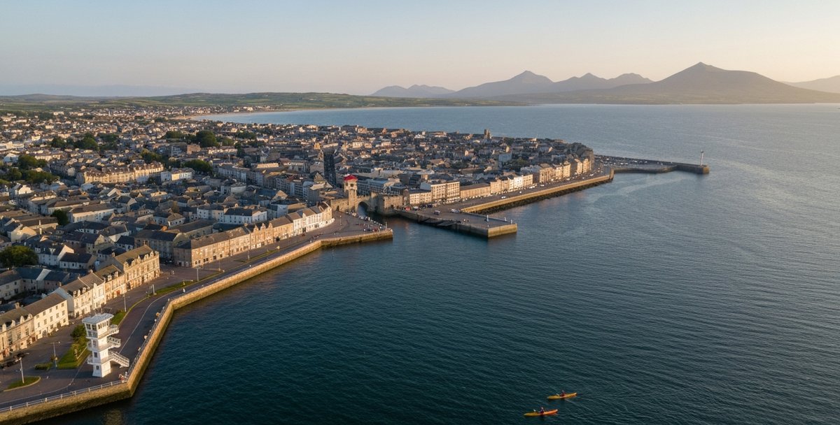
Galway’s paddling geography runs from the sheltered sea bay on the city’s doorstep, up the river through the centre, out onto the great inland lake, and then west and north into the Atlantic.
Zone 1 — Galway Bay and Salthill is the sheltered inner-bay sea paddling on the city’s western edge, centred on Rusheen Bay and the Salthill promenade. This is where a Galway kayak trip starts for most people.
Zone 2 — The River Corrib Through the City is the six-kilometre urban river that drains Lough Corrib into the sea. The lower gorge and the Salmon Weir are dangerous; the upper reaches near Menlo are calm. Guided city paddles run the safe line through it.
Zone 3 — Lough Corrib is the second-largest lake in Ireland, a freshwater world of islands, ruins and wild brown trout that is often calmer than the coast in Atlantic weather, though it is still a large body of open water where wind and fetch need respect.
Zone 4 — The Connemara Coast is the exposed Atlantic west, from the turquoise coral strand at Mannin Bay to the island maze between Roundstone and Clifden, with the Aran Islands on the horizon.
Zone 5 — Killary Fjord is often described as Ireland’s only fjord, on the Galway-Mayo border, a sixteen-kilometre corridor between mountains that accelerates the wind and is reserved for guided sea-kayak trips.
| Zone | Difficulty | Water | Beginners OK | Best Season | Access |
|---|---|---|---|---|---|
| Zone 1 — Galway Bay & Salthill | Beginner–Intermediate | Sheltered sea bay | Yes (Rusheen Bay) | Apr–Oct | Rusheen Bay hire; Blackrock slipway |
| Zone 2 — River Corrib (city) | Beginner (guided) / Advanced (weir) | Fast city river | Guided only | Apr–Sep | Guided tour — do not run the weir |
| Zone 3 — Lough Corrib | Beginner (sheltered bays) – Advanced (open water in wind) | Freshwater lake | Yes, sheltered bays | Apr–Oct | Oughterard & Cornamona piers |
| Zone 4 — Connemara Coast | Intermediate–Advanced | Exposed Atlantic | Guided (Mannin Bay) | May–Sep | Guided tour or experienced groups |
| Zone 5 — Killary Fjord | Intermediate (guided) | Fjord | Guided only | May–Sep | Guided sea-kayak trip only |
Zone 1 — Galway Bay and Salthill
Galway Bay is the reason the city exists, and the sheltered inner corner of it on the Salthill side is the natural first paddle of any Galway trip. The prevailing south-westerly swell is broken up before it reaches the shore by the low ground of Mutton Island and the Silverstrand headland, which leaves a band of manageable water along the north shore even on days when the outer bay is committing.
The obvious starting point is Rusheen Bay, five kilometres west of the city centre off the Salthill road — a fifteen-minute drive or a half-hour cycle from Eyre Square. The bay is a shallow, sand-bottomed sea inlet, partly enclosed by the Mutton Island peninsula and the Silverstrand headland, and it is the only place in Galway where a complete beginner can hire a kayak and paddle it on their own terms rather than a formal guided tour. The bottom is forgiving, the water is protected, and a launching error is recoverable. Rusheen Bay Watersports runs self-paddle hire here from April to November — €25 for two hours in a single or €45 for a double, wetsuit and booties included in the price — with staff briefing every group before they go out. Sessions are weather and tide dependent and can be cancelled or rescheduled at short notice, so a booked slot is not guaranteed to run. The rental area runs to the line between Silverstrand and Mutton Island; beyond that you are in open Galway Bay, which is guided territory.
For a longer sea trip, the classic intermediate route runs east from Salthill to Rinville. Launch from the slipway at the Blackrock diving tower on the Salthill promenade — the tower itself is a Galway institution, with swimmers going off it into the Atlantic year-round. From there the route follows the north shore for roughly ten kilometres of shoreline paddling, past the Claddagh basin and the mouth of the River Corrib, which produces a noticeable current on an ebbing tide, and on through Ballyloughane to Renmore before finishing at Rinville Park — a paddling distance that runs longer than the road route, since it hugs the coast in and out of the small bays rather than cutting straight across. The eastern end at Oranmore Bay is part of the NPWS Galway Bay Complex SAC, and the intertidal mud holds wintering flocks of Brent geese, curlew, redshank and bar-tailed godwit from October to March. Give the mudflats a wide berth on that stretch, especially at low tide — paddling through a resting or feeding flock forces birds to burn energy they need for the winter, so swing wide rather than cutting close to the shoreline where they gather. It is a point-to-point paddle that needs a shuttle — the road distance between Salthill and Rinville is about ten kilometres, twenty minutes by the coast road.
The tide is the thing that catches people out here. Galway has a large spring range — roughly 4.5 metres, from a mean high-water springs of about 5.1 metres down to 0.6 metres — and at low water springs the inner bay drains to a wide plain of exposed mud that makes progress impossible. Check the tide before you launch and plan to be on the water within a couple of hours of high tide if you are working the shoreline east of Salthill.
Silverstrand, about two miles west of Salthill, is a small sheltered beach with promenade parking for around sixty vehicles and a gentle launch — a good put-in for a short, contained paddle when Rusheen is busy.
Key logistics — Zone 1:
- Beginner hire: Rusheen Bay Watersports — self-paddle, €25/2hr single, €45/2hr double, wetsuit included, Apr–Nov — rusheenbay.com
- Sea-touring launch: Blackrock diving tower slipway, Salthill promenade; Silverstrand beach (short paddles)
- Difficulty: Beginner (Rusheen Bay); Intermediate (open bay, Salthill–Rinville)
- Tide: Spring range ~4.5 m; inner bay dries to mud at low water springs — paddle near high water
- Wildlife: Grey seals at Mutton Island; wintering geese and waders at Oranmore Bay (Oct–Mar)
- Emergency: VHF Ch 16 / 999 / 112, ask for the Coast Guard
Zone 2 — The River Corrib Through the City
No other Irish city has a river like the Corrib, and it is worth understanding exactly what it is before you go near it. The Corrib is only about six kilometres long — one of the shortest rivers on the continent — and it is the sole outlet to the sea for three substantial lakes: Lough Corrib, Lough Mask and Lough Carra. All of that water is funnelled through a short channel in the middle of a city, which is why the Irish Times, in a 2025 piece on the river, called it the fastest-flowing city river in Europe. Its mean long-term flow is about 105 cubic metres a second, which makes it the second-largest river in Ireland by volume after the Shannon. That is a lot of moving water for something you can walk across the bridges of in ten minutes.
Handled correctly, the Corrib gives you the most unusual urban paddle in the country. Give It A Go, a mobile operator, runs a guided kayak tour on the river through the city centre — the Galway equivalent of paddling the Liffey through Dublin, past the Cathedral, the university and the medieval quays. The exact put-in and take-out points vary with conditions and the group on the day, so confirm the current route when you book. It is photogenic, accessible and short, and it is done under supervision for good reason.
The Salmon Weir Is Not Optional Knowledge
The single most important safety fact in this guide concerns the Salmon Weir, the sloped barrage in the centre of the city just below the cathedral. In January 2023 two University of Galway rowing boats carrying ten novice rowers were swept toward the weir and capsized; all were rescued by club safety launches, and a school crew capsized nearby in the same incident. The Marine Casualty Investigation Board investigated and, reporting in April 2024, found that patterns of risky behaviour around the weir had become “normalised” and posed “a threat of death or serious injury” to the crews involved. That is an official finding about experienced club crews with safety cover on hand. A recreational kayaker who drifts onto the weir in high flow, without that cover, is in a far worse position.
The practical rule is simple: do not attempt the Salmon Weir or the lower gorge on your own. Paddle the Corrib with an operator who knows the safe line and the flow conditions, or stay on the calm upper reaches near Menlo where the current is slack.
Menlo and the Upper River
Upstream of the weir the river opens out and slows, and the stretch around Menlo Pier — three kilometres from the city centre, beside Menlo Cemetery — is where the guided-tour operators launch their lake and river trips. Menlo Castle, a ruined Blake family tower house dating to around 1569, stands on the bank; it was gutted by a fire on 26 July 1910 that the local press called the worst in the west of Ireland in half a century, and its ivy-covered shell is one of the more atmospheric things you will pass on the water anywhere near a city.
The lower river carries a thousand years of Galway with it. The Claddagh, the ancient fishing village at the river mouth, sent its distinctive sail and row boats — the ancestors of the Galway hooker, which grew from smaller craft after 1790 — out into the bay for centuries; Lewis’s Topographical Dictionary recorded around 140 sail boats and 50 row boats employing close to 2,200 people in the Claddagh fishery in the 1830s. The Spanish Arch, on the eastern bank at the mouth, was built in 1584 by Wylliam Martin, the city’s 34th mayor, as an extension of the medieval town wall, and was partly destroyed by the tsunami that reached Galway from the 1755 Lisbon earthquake. The Eglinton Canal, cut through the city between 1848 and 1852 and formally opened in August 1852, once carried working boats between the lake and the sea until its swivel bridges were replaced with fixed ones in 1954. You paddle past all of it.
On launch permits: there is no published permit requirement for launching a kayak on the Corrib at Newcastle, Menlo or the Claddagh, but the navigation authority is the Lough Corrib Navigation Trustees together with Galway City Council rather than Waterways Ireland, so if you are organising a group launch it is worth a call to the council to confirm current arrangements.
Key logistics — Zone 2:
- Guided city paddle: Give It A Go — guided tour on the city stretch of the Corrib, exact route confirmed on booking, giveitago.ie
- Upper-river / lake launch: Menlo Pier (3 km upriver, beside Menlo Cemetery)
- Difficulty: Beginner with a guide on the safe line; Advanced-only near the weir/gorge
- Critical hazard: The Salmon Weir — subject of a 2024 MCIB report after a capsize incident; do not run it independently
- Season: April–September for the guided city paddle
- Permit: None published; group launches — check with Galway City Council / Corrib Navigation Trustees
Zone 3 — Lough Corrib
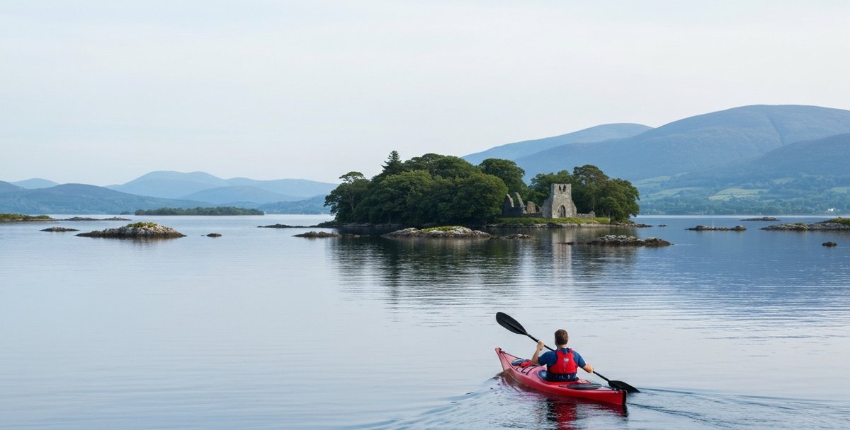
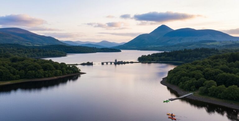
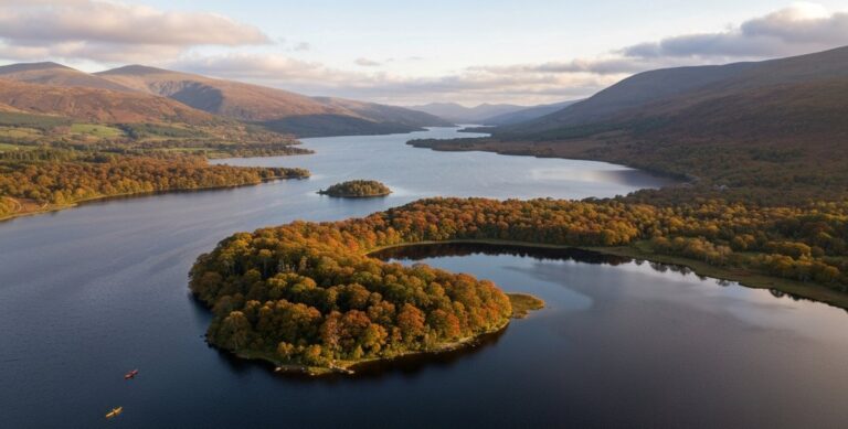
Lough Corrib is the antidote to the Atlantic. It is the largest lake in the Republic — roughly 176 square kilometres — stretching from the edge of Galway city north to within a few kilometres of Killary, and it is shielded from the open coast by the Connemara and Joyce Country mountains. It is often paddleable on days the sea forecast rules out the coast, but it is still a large lake with long open stretches, and wind blowing the length of it can build a dangerous chop with real fetch behind it — check the forecast and stay within the sheltered island strings when it is blowing.
The lake is scattered with islands — local tradition puts the count at three hundred and sixty-five, one for every day of the year, though most are small limestone outcrops rather than named islands. The largest inhabited one, Inchagoill, sits in the southern basin and is the natural turn-point for a day paddle. It holds two small twelfth-century church ruins and the Lia Lugnaedon, a carved pillar stone whose inscription dates to the early sixth century and is considered the oldest Christian inscription in the Latin alphabet in Ireland. There are very few landing options on Corrib once you are past the island cluster, so Inchagoill’s small jetty is worth planning a stop on.
The two practical launch bases are at opposite ends of the lake. Oughterard Pier in the south has a public slipway and gives access to the sheltered southern island string — the standard beginner-to-intermediate paddling ground, using Inchagoill as a turn-point. Cornamona, on the north shore, sits at the base of a steep wooded valley where the surrounding terrain blocks the prevailing west wind, and it is the base for Lough Corrib Adventures, who run guided trips out to the northern islands and offer self-paddle hire alongside. Their site has an on-site sauna and a coffee trailer — a genuinely welcome thing after an October paddle in single-digit air with sub-ten-degree water.
Corrib is one of the most important wild brown trout fisheries in Europe, and understanding that changes how you paddle it. From the season opening in mid-February through September you will share the water with flotillas of gillie-skippered angling boats drifting the shallows, and they deserve a wide berth — especially around the mayfly hatch in May, when the fishing is at its most intense. The trout run to a good size: an average fish is around a pound and a quarter, fish to five pounds are not uncommon, and the lake gave up a record ferox brown trout of 23 pounds 12 ounces to angler Ceri Jones in May 2012, caught near Inchagoill. The Twelve Bens are visible to the north-west across the water.
At the northern top of the system, near Cong, the lake runs up against Ashford Castle — built in 1228, bought by Sir Benjamin Guinness in 1852, and opened as a hotel in 1939 — one of the more spectacular backdrops on any Irish paddle.
Key logistics — Zone 3:
- Southern launch: Oughterard Pier — public slipway; Inchagoill turn-point
- Northern launch: Cornamona — Lough Corrib Adventures (guided + self-paddle hire, sauna on site)
- Difficulty: Beginner–Intermediate; stay within the sheltered southern island string in wind
- Season: April–October
- Share the water: Angling boats mid-Feb–Sep — give wide berth, especially at the May mayfly hatch
Zone 4 — The Connemara Coast
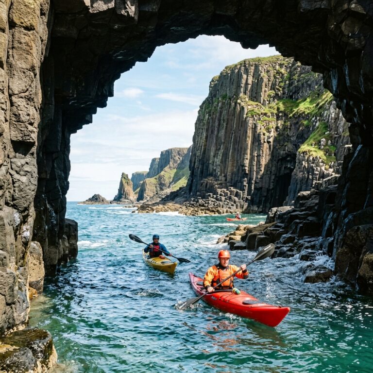
West of the lake the county turns to the open Atlantic, and Connemara is a different order of paddling — a labyrinth of granite islands, skerries and channels facing two thousand kilometres of open ocean with nothing to break the swell. Parts of it are among the finest sea kayaking in Ireland; parts of it are firmly for experienced groups only.
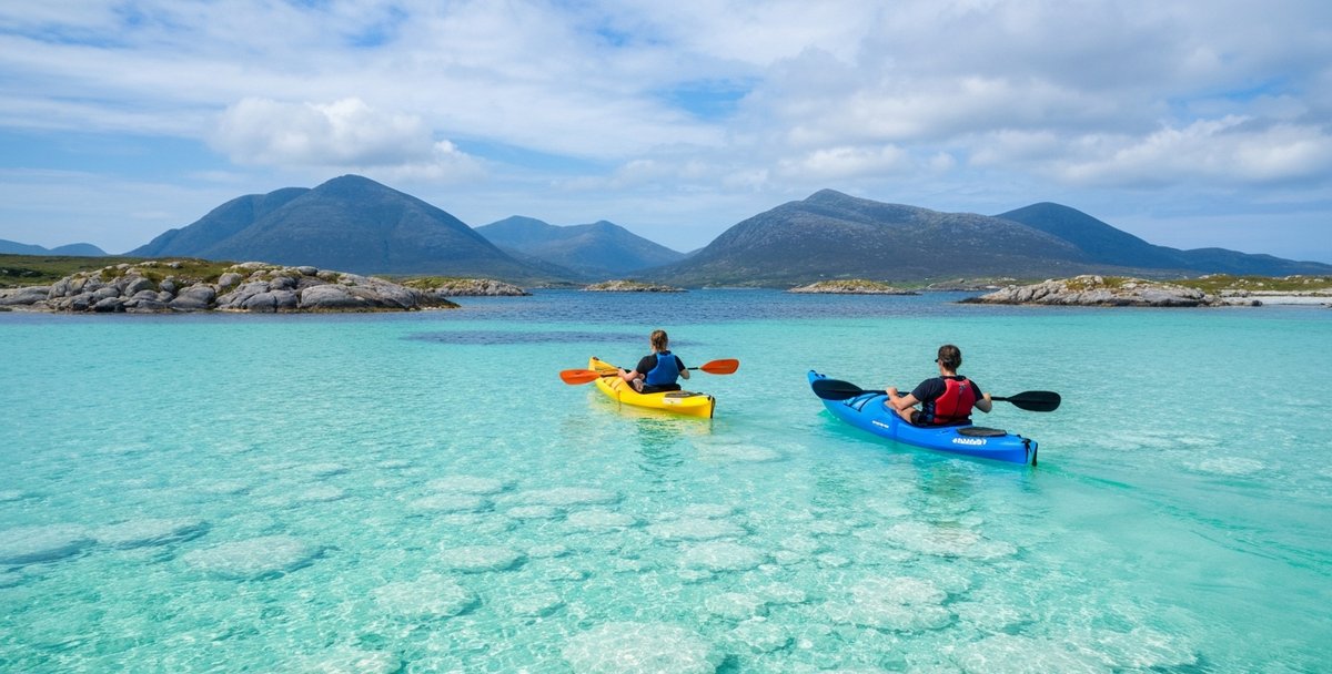
The gentle end is Mannin Bay, on the south Connemara coast between Ballyconneely and Clifden. The bay owes its extraordinary colour to a white marl beach — the “coral strand” — made not of true coral but of fragments of calcified coralline algae, which turns the shallow water an improbable Caribbean turquoise on a sunny day. It is sheltered, shallow and beginner-friendly, with small islands like Cruagh to explore; the standard loop around the bay’s islands is about seven kilometres, one of the gentlest sea paddles on the west coast. This is where the Connemara guided operators run their coastal tours, and it is the right introduction to Atlantic paddling for someone who has only ever paddled a bay or a lake.
The committing end is the point-to-point run from Roundstone to Clifden, roughly eighteen kilometres of exposed coast through a maze of low islands and submerged rocks, with the Twelve Bens — Benbaun rising to 729 metres — as an inland backdrop and seals commonly hauled out on the rocks. It is an advanced trip that needs Ordnance Survey mapping, a compass or GPS, a VHF radio and a filed float plan; the low islands look identical from water level, and in a south-westerly above Force 4 the swell that wraps around the headlands can make the exposed sections genuinely dangerous. Allow a full day and a shuttle — the road distance back to Roundstone is about twenty-five kilometres.
Out beyond the mouth of the bay, roughly forty-eight kilometres from Galway, the three Aran Islands sit on the horizon. They are a serious open-crossing objective rather than a day-trip paddle, but they are the view that defines the western skyline from every Connemara launch.
Key logistics — Zone 4:
- Beginner-friendly: Mannin Bay coral strand, Ballyconneely — sheltered, ~7 km island loop; guided coastal tours available
- Advanced: Roundstone to Clifden — ~18 km exposed point-to-point, VHF and float plan essential, shuttle ~25 km
- Difficulty: Intermediate (Mannin Bay, guided) to Advanced (open Connemara coast)
- Season: May–September for settled Atlantic windows
- Hard limit: South-westerly above Force 4 makes the exposed headlands dangerous — turn back
Zone 5 — Killary Fjord
At the northern edge of the county, on the Galway-Mayo border, the land opens into Killary Harbour — often described as Ireland’s only fjord, a sixteen-kilometre glacial inlet running inland between Mweelrea, at 814 metres the highest mountain in Connacht, and the Maamturk range. On a still evening it is one of the most beautiful pieces of water in the country, the mountain walls dropping straight into dark, calm water lined with mussel rafts.
It is also a wind trap. The mountains on both sides funnel the prevailing south-westerly through the narrowing corridor and speed it up, so the wind on the water can run noticeably stronger than the forecast for the wider area suggests — check the marine forecast before you go and treat the number on it as a floor, not a ceiling. None of the operators currently running trips on Killary list self-paddle rental; every one of them runs it as a guided sea-kayak trip, which suits the conditions. For an experienced paddler who wants the mountain backdrop, a guided Killary trip is one of the standout half-days on the west coast; for anyone else, it is simply not a place to be out alone.
Key logistics — Zone 5:
- Access: Guided sea-kayak trips only; launches from the Leenane end of the fjord
- Difficulty: Intermediate, guided trips only — no self-paddle hire currently offered on Killary
- Hazard: Wind acceleration — the fjord funnels and speeds up the wind, so expect it to feel stronger on the water than the forecast figure
- Season: May–September
Wildlife on the Water
The wildlife shifts with the water type. On Galway Bay, grey seals haul out on the rocks around Mutton Island, whose lighthouse — built in 1815 and first lit in 1817 — still marks the inner bay; the Oranmore mudflats at the eastern end hold internationally significant flocks of Brent geese and waders through the winter. On Lough Corrib, the wild brown trout are the headline, but the islands also carry nesting waterbirds and the occasional otter, and white-tailed eagles reintroduced to the wider region are increasingly seen overhead. On the Connemara coast and in Killary, common and grey seals are regularly seen hauled out on the rocks, and the deeper Atlantic water off the headlands holds harbour porpoise and, in a good summer, dolphins. The thing that makes Galway unusual is how quickly the cast changes: a seal colony on a sea bay in the morning, a trout lake at midday, an Atlantic fjord in the evening, each with its own animals.
Paddling Clubs in County Galway
Galway has a genuine paddling community, and joining a club is the cheapest way to progress past rental water.
University of Galway Kayak Club is one of the oldest and largest, founded in 1977 and maintaining a fleet of over 65 boats of various types for its members. It is a student club covering river, sea and surf paddling, and it is contactable at kayak@clubs.universityofgalway.ie or through the Sports Unit on (091) 493 482; the club also runs an active Instagram at @unigalwaykc. It is the natural home for a student who wants to learn to paddle properly rather than pay for guided tours.
Galway Kayak Club is the city’s community club, covering sea and river paddling for members outside the university. Membership and joining details are on galwaykayakclub.com or by email at galwaykayakclub@gmail.com; the club posts trips and sessions on Instagram at @galway_kayak_club. Club membership across Ireland typically runs around €100 a year and unlocks club boats, pool sessions and group trips on water you would not safely attempt alone. The full Connacht listing is in our kayaking clubs in Ireland guide.
Getting There
Galway city is about 210 kilometres from Dublin, a little over two hours on the M6. The city is the hub for all five zones: Rusheen Bay and the Salthill launches are fifteen minutes west of the centre; Menlo and the River Corrib launches are on the city’s northern edge; Oughterard on Lough Corrib is a half-hour north-west on the N59; Cornamona and Cong are around an hour north; and the Connemara coast — Roundstone, Clifden, Mannin Bay — is between an hour and an hour and a half west on the N59 and R341. Killary is roughly ninety minutes north-west via Leenane. There is a rail link to Galway city from Dublin and Limerick, but the coastal and lake launches all need a car.
Tides, Weather and Safety
Tides
Tides matter most in Galway Bay, which has a spring range of about 4.5 metres — a mean high-water springs of roughly 5.1 metres down to a mean low-water springs of about 0.6 metres. The inner bay east of Salthill dries to extensive mudflats at low water springs, so shoreline routes there need to be run within a couple of hours of high tide. The River Corrib produces a noticeable ebb current at its mouth by the Claddagh. Lough Corrib, being an inland lake, has no tide — its variable is wind, not water level.
Weather
The controlling factor across the whole county is Atlantic exposure, and the wind is the number that decides the day. The Met Éireann marine forecast covers this coast; check it before every sea outing. The sheltered venues — Rusheen Bay, the Salthill inner shore, and Lough Corrib inside its mountain ring — tend to give usable days when the open coast is closed, which is why the zones are graded the way they are.
Wind speed on its own does not tell the whole story. Direction, gusts, swell, tide and current, how exposed your particular launch is, and your own skill level all change what a given force actually means on the water, so treat the table below as a starting point, not a green light.
| Force | Wind (knots) | Galway advice |
|---|---|---|
| F0–F2 | 0–6 | Comfortable in the sheltered venues. On the open Connemara coast and Killary, check direction and swell before committing — a small onshore wind against swell can still be uncomfortable |
| F3 | 7–10 | Sheltered zones fine. Open Connemara coast for experienced paddlers only, and only with a favourable wind direction |
| F4 | 11–16 | At or beyond most paddlers’ limit on the exposed Connemara headlands. Killary’s fjord shape accelerates the wind further. Bay and lough depend on how sheltered your specific stretch is from the fetch |
| F5 | 17–21 | Open coast not advisable. Lough Corrib or the most sheltered bay corners only, away from open fetch |
| F6+ | 22+ | No sea paddling. Lough Corrib sheltered bays only, with care, and only for paddlers confident handling wind on open water |
Water Temperature and Cold-Water Shock
West-coast sea temperatures stay colder than the south or east coast through the year, and even in summer they are cold enough that cold-water shock is a real risk on immersion — the involuntary gasp reflex can incapacitate even a strong swimmer for the first ninety seconds. Dress for the water, not the air: a wetsuit is the safer choice whenever a capsize or extended immersion is realistically possible, and it becomes essential as the water cools through autumn and winter. The Irish Water Safety cold-water-shock guidance is the reference, and every operator’s briefing covers it.
Safety Contacts
For the Galway Bay and Connemara coast, the responsible station is Marine Rescue Sub-Centre Valentia, which covers the coast from Ballycotton in Cork to Clifden in Galway — the direct line is +353 66 947 6109, and it monitors VHF Channel 24 and MF 1752 kHz. North of Clifden, including Killary, cover passes to MRCC Malin Head, with the Westport Coast Guard unit covering the Killary-to-Mulranny stretch. Galway RNLI, based at the New Docks in the port, has been on service on Galway Bay since 1996 and has run its current Atlantic 85 lifeboat, Binny, since 2011 (replacing the previous boat, Dóchas); by the station’s thirtieth anniversary in 2026 it had launched 816 times and saved 74 lives.
In any emergency, dial 999 or 112 and ask for the Coast Guard, or make a VHF Channel 16 distress call.
Season by Season
January to March — The coast is an experienced-paddler environment in Atlantic swell. Lough Corrib is the sensible winter option on a settled day, and Galway Bay holds wintering geese and waders at Oranmore.
April to May — The season opens. Rusheen Bay hire starts; the Connemara guided operators begin their coastal tours; Lough Corrib is at its best before the summer crowds, though the May mayfly hatch brings the angling fleet out in force. Settled high-pressure spells make the first realistic Connemara days.
June to August — Peak season. Warmest water, longest daylight, all five zones in play. Book Connemara guided tours and Rusheen Bay weekend slots ahead — the small-group operators sell out weeks in advance for July and August.
September to October — The inland loughs stay excellent while the open coast starts seeing Atlantic depressions that shut down the bay and Connemara operators on short notice. Lough Corrib Adventures at Cornamona, with its sauna, is a fine late-season paddle.
November to December — Rusheen Bay closes in mid-November. The coast is for experienced paddlers only; Lough Corrib’s sheltered southern bays remain the safest option on a calm day.
Operators, Hire and Lessons — 2026
Galway’s operators split by water type: sheltered-bay self-paddle hire, guided river and lake tours, and guided Atlantic coastal trips. Prices below are per person for 2026. Where a fixed rate is published, it was checked against the operator’s own site on 7 September 2026 and the site is linked so you can check it again yourself; where an operator doesn’t publish a fixed rate, that is marked and you should confirm directly when you book. Guided rates often vary by group size regardless.
Self-Paddle Hire
Rusheen Bay Watersports — the only self-paddle kayak hire near Galway city, on a sheltered sea bay a first-timer can handle with the operator’s briefing.
- Launch: Rusheen Bay, 5 km west of Galway city
- Price: €25 / 2 hr single, €45 / 2 hr double, €80 / 2 hr family (4 people) — wetsuit and booties included (checked against rusheenbay.com, 7 Sept 2026)
- Season: April–November | Website: rusheenbay.com | Phone: +353 87 260 5702
Guided River and Lake Tours
Give It A Go — a mobile operator running guided trips on Galway Bay, Lough Corrib and, most distinctively, the River Corrib through the city centre.
- Launch: Mobile — River Corrib, Lough Corrib, or Galway Bay, put-in confirmed on booking
- Price: €55 adult / €35 junior (under 16), half-day (3 hr) guided (checked against giveitago.ie, 7 Sept 2026)
- Season: River and bay tours run through the main season; confirm current lough dates | Website: giveitago.ie | Phone: +353 87 191 4911
Kayakmor — sea and lake kayak tours and courses run by paddler Jim Morrissey, launching from Menlo Pier on the River Corrib and from several piers on Lough Corrib (Luimnagh, Keekil, Kilbeg and Cong), plus Galway Bay tours in settled weather.
- Launch: Menlo Pier (River Corrib); multiple Lough Corrib piers; Galway Bay
- Price: Adult tours roughly €45–€70 per person depending on group size — confirm current rate when booking
- Website: kayakmor.ie | Phone: +353 87 756 5578 / +353 93 36097
Lough Corrib Adventures — guided tours and self-paddle hire from Cornamona on the north shore, with a sauna and coffee on site.
- Launch: Cornamona Pier, north Lough Corrib
- Price: Guided 2-hour tour from around €35 per person (confirm on the current booking page); self-paddle hire also available
- Website: loughcorribadventures.com | Phone: +353 87 339 6215
Wildlands — sit-on-top kayaking sessions on Ballyquirke Lake at the adventure park in Moycullen, a good family option.
- Launch: Ballyquirke Lake, Moycullen | Season: Fri–Sun and holidays (weekdays by arrangement)
- Price: Contact for current kayaking rates | Website: wildlands.ie | Phone: 091 868 900
Corrib Kayaks — a Moycullen-based operator running guided tours and rental on Lough Corrib, booked through its Facebook page.
- Launch: Moycullen, Lough Corrib
- Price: Contact for current rates | Contact: facebook.com/corribkayaks · +353 89 460 0405 · corribkayaks@gmail.com
Guided Connemara Coastal Tours
Real Adventures Connemara — guided coastal sea kayaking on Mannin Bay near Ballyconneely, about fifteen minutes from Clifden.
- Launch: Connemara Sands Hotel area, Mannin Bay, Ballyconneely
- Price: Groups of 1–9: €69 adult / €55 child; groups of 10+: €65 adult / €50 child. Two daily sessions (checked against realadventures.ie, 7 Sept 2026)
- Website: realadventures.ie | Phone: +353 85 146 2526
Connemara Wild Escapes — guided sea kayaking on Mannin Bay, Roundstone Bay and Killary Fjord.
- Launch: Mannin Bay and Roundstone Bay (Connemara); Killary Fjord
- Price: Around €60 per adult for the 2.5-hour coastal tour — confirm current rate; Roundstone Bay tour runs March–September, small groups (min 2, max 6)
- Website: connemarawildescapes.ie | Phone: +353 95 49052
| Operator | Water | Model | Price (2026) | Season |
|---|---|---|---|---|
| Rusheen Bay Watersports | Sheltered sea bay | Self-paddle hire | €25 single / €45 double / 2 hr | Apr–Nov |
| Give It A Go | River Corrib / bay / lough | Guided 3 hr | €55 adult / €35 junior | River/bay in season; confirm lough dates |
| Kayakmor | River Corrib / Lough Corrib / bay | Guided tours + courses | ~€45–€70 by group size | Apr–Oct |
| Lough Corrib Adventures | Lough Corrib (north) | Guided + hire | Guided from ~€35 pp | Seasonal |
| Wildlands | Ballyquirke Lake | Sit-on-top sessions | Contact | Fri–Sun + holidays |
| Corrib Kayaks | Lough Corrib | Guided + rental | Contact | Seasonal |
| Real Adventures Connemara | Mannin Bay (coast) | Guided coastal | €69 adult / €55 child | Seasonal |
| Connemara Wild Escapes | Connemara coast / Killary | Guided coastal / fjord | ~€60 adult | Mar–Sep |
For self-paddle hire specifically — including the wider Galway and Mayo picture from Rusheen Bay up to Westport — see our dedicated Kayak Rental Galway & Mayo guide.
Frequently Asked Questions
Where can I kayak in Galway city? The two city options are the River Corrib and the inner Galway Bay shore. The Corrib runs straight through the centre and is best paddled on a guided tour with Give It A Go, which puts in above the Salmon Weir and finishes at the Claddagh. For self-paddle, Rusheen Bay on the western edge of the city is the beginner-friendly sea bay.
Is the River Corrib safe to kayak? Only with knowledge of the flow and the hazards. The Corrib is billed as the fastest-flowing city river in Europe, and the Salmon Weir in the city centre is genuinely dangerous — a January 2023 capsize incident there led to a Marine Casualty Investigation Board report in 2024 warning of a “threat of death or serious injury.” Do not attempt the weir or the lower gorge independently. Paddle the river with an operator who knows the safe line, or stay on the calm upper reaches near Menlo.
Can beginners go kayaking in Galway? Yes. Rusheen Bay Watersports, five kilometres west of the city, rents kayaks for independent paddling on a sheltered, sand-bottomed sea bay — €25 for two hours in a single, wetsuit included. Lough Corrib from Oughterard and the guided Mannin Bay coastal tours in Connemara are also beginner-appropriate.
Where can I kayak on Lough Corrib? The two main launch bases are Oughterard Pier in the south, which has a public slipway and gives access to the sheltered southern islands and Inchagoill, and Cornamona in the north, where Lough Corrib Adventures runs guided trips and self-paddle hire. The lake is often calmer than the coast when Atlantic weather closes in, but it is still a large open lake, so check wind and fetch before a long crossing.
Is there sea kayaking in Connemara? Yes. Mannin Bay near Ballyconneely — the turquoise “coral strand” — is a sheltered, beginner-friendly bay with guided coastal tours from operators like Real Adventures Connemara and Connemara Wild Escapes. The Roundstone-to-Clifden run is an eighteen-kilometre advanced trip for experienced groups with VHF and a float plan.
Can you kayak Killary Fjord? Only on a guided sea-kayak trip. Killary is often described as Ireland’s only fjord, and its shape accelerates the wind funnelling down the corridor, so it can run stronger on the water than the wider forecast suggests. None of the current operators offer self-paddle rental there; it is run as a guided trip, which suits the conditions.
Do you need a permit to kayak the River Corrib? There is no published permit requirement for launching a kayak at Newcastle, Menlo or the Claddagh. The navigation authority is the Lough Corrib Navigation Trustees together with Galway City Council, so if you are organising a group launch it is worth confirming current arrangements with the council first.
Do I need a wetsuit to kayak in Galway? On the sea, generally yes. West-coast Atlantic water stays cold enough through the year to cause cold-water shock on immersion, even at the height of summer. A wetsuit is the safer choice whenever there’s a real chance of capsize or extended immersion; Rusheen Bay includes one in its hire price. The inland loughs run milder in summer, but conditions and personal cold tolerance vary, so check with your operator.
Planning Your Trip — Summary
Beginners should start at Rusheen Bay Watersports — sheltered, weather and tide dependent, full kit and a briefing included, fifteen minutes from Eyre Square — or take a guided tour on Lough Corrib or Mannin Bay. Improving paddlers get real variety here: the guided River Corrib city paddle with Give It A Go, the island loops on Lough Corrib from Oughterard, and the Mannin Bay coral strand are all within an hour of the city. Experienced sea kayakers come for the Connemara coast and Killary — the Roundstone-to-Clifden run and a guided Killary fjord trip are the standout objectives, both dependent on a settled Atlantic window. Whatever the plan, check the Met Éireann marine forecast, respect the Salmon Weir, carry wetsuit-grade thermals for any sea outing, and use Lough Corrib as the fallback when the coast closes down.
Also Read
- Best Places to Kayak in Ireland — 16 Spots Rated and Mapped — how the Connemara Coast stacks up nationally, plus 15 more of the island’s best routes.
- Sea Kayaking Ireland — Complete Guide — national overview of conditions, gear and planning for Irish coastal paddling, the natural next step from a guided Connemara tour.
- Kayak Rental Galway & Mayo — Rusheen Bay to Westport — the dedicated west-coast hire directory, with every verified self-paddle rental operator and current rates.
- Kayaking for Beginners Ireland — what to expect on a first paddle, and the Canoeing Ireland course pathway with Galway and Mayo providers.
- Kayaking Clubs in Ireland — 45 Verified Clubs by County — the full club listing, including the University of Galway and Galway Kayak clubs.
- Kayak Rental Ireland — 54 Verified Operators by County — the national hire directory this guide feeds into.
- Blueways Ireland — Every Paddling Trail Mapped — the marked-trail network, including the Lough Corrib and wider Shannon-system waters.
No comments yet on this guide.
Be the first to share your experience — conditions, access, hazards, or anything a future paddler should know.
Login to join the discussion