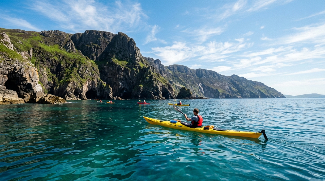
County Mayo has two completely different kayaking personalities. On the south side of Achill Island and around Clew Bay, you find a labyrinth of sheltered drumlin islands, calm tidal channels, and beginner-friendly inlets backed by the unmistakable silhouette of Croagh Patrick. On the western and northern edges of Achill, the Atlantic shows its true face — towering sea cliffs, powerful groundswell, and sea caves that are among the most dramatic on the western seaboard. This guide covers both worlds in full.
Whether you are planning a family day on Clew Bay or an advanced sea kayak trip along Achill’s Keem Bay coastline, here is everything you need to know about kayaking in Mayo in 2026.
1. Why Mayo is One of Ireland’s Greatest Paddling Counties
County Mayo stretches across one of the largest and most varied coastlines in Ireland. Its geography divides naturally into two distinct paddling environments that sit side by side but demand completely different skills and equipment.
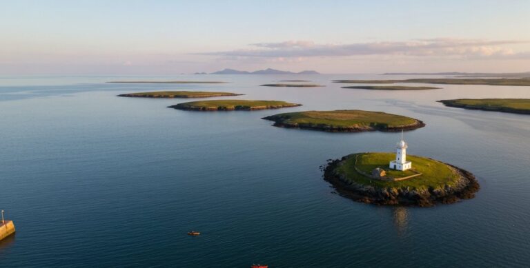
Clew Bay on the southern approach to Achill is a drowned drumlin field — a glacial landscape where hundreds of rounded hills were submerged by rising sea levels after the last Ice Age, leaving their peaks above water as a labyrinth of 365 islands (the local tradition claims one for every day of the year). The channels between these islands are sheltered, the tidal currents are manageable, and the views toward Croagh Patrick make it one of the most scenically rewarding paddles in the west of Ireland.
Achill Island itself, reached by bridge from the mainland, is a completely different matter. The island faces the full force of the North Atlantic. Its western cliffs — including the Croaghaun cliffs at 688 metres — are among the highest in Europe. The northern Dugort coast has been designated an official Blueway kayak trail, and Keem Bay has an official Blueway too — though Keem’s is a snorkel trail rather than a paddling route — bringing infrastructure and guided access to some of the most spectacular coastal scenery in the country.
The contrast makes Mayo exceptional: in one county, on one day, you can genuinely choose between a beginner’s lake paddle and a committing open-ocean sea kayak route.
2. Who Should Paddle in Mayo?
Mayo’s varied geography means there is genuinely a route for every level, but you must choose the right one.
- Absolute Beginners (Level 1): Keel Lake (Achill Island) and the sheltered southern bays of Clew Bay near Westport. Flat, calm water, suitable for sit-on-top kayaks. The River Moy near Ballina on a settled day is also accessible for first-timers.
- Novice to Intermediate (Level 2–3): Clew Bay island-hopping from Westport or Murrisk. The channels are sheltered but require basic navigation skills, as the drumlin islands all look identical from the water. Tidal currents between the islands can reach 3 knots at spring tides.
- Advanced Sea Kayakers (Level 4+): The Keem Bay coast on Achill’s southern edge, the Dugort Blueway on the northern coast, and the outer headlands of the Achill Sound. These are committed open-ocean routes with no landing spots for extended sections, significant groundswell, and tidal race conditions at the points.
3. When to Go: Weather, Swells, and Water Temperature
Timing matters more in Mayo than almost anywhere else in Ireland, because the western coast is exposed to weather systems arriving unbroken across the Atlantic.
The Season
Coastal paddling in Mayo is most consistent May through September, with June, July, and early August offering the most frequent settled spells. Even within this window, safety comes down to the forecast for that specific day, not the calendar. The prevailing south-westerly winds in Ireland are the primary factor. For Keem Bay and the western cliffs, what’s paddleable depends on wind direction and strength, swell height, tide state and paddler ability together. A south-westerly, even a relatively moderate one, can build the sea state at exposed headlands rapidly, and an easterly here blows offshore, which can carry paddlers away from the coast rather than make things safer.
The Swell Factor
Wind is not your only concern. Even on a windless day, Atlantic groundswell generated by distant storms can be running. A 2-metre groundswell with a 12-second period looks innocuous from the cliff top but creates powerful surge in sea caves and clapotis (reflected swell) at cliff bases. Always check a swell forecast — the Met Éireann marine forecast covers swell height and direction, and tools like Windy show swell period.
Water Temperature
The Atlantic off Mayo rarely exceeds 15°C, even in late August. What you wear should match the water temperature, conditions, trip duration and how exposed you are if you end up in the water: a wetsuit is the sensible minimum for most coastal paddling here, and a drysuit is worth considering for shoulder season (April, May, September, October) or for longer trips below Canoeing Ireland Level 4.
| Beaufort Force | Wind Speed (knots) | Atlantic Conditions | Recommendation for Mayo Paddlers |
|---|---|---|---|
| Force 0–2 | 0 – 6 knots | Glassy to small wavelets | Good for beginners in sheltered bays. Cave and cliff routes still depend on swell, not wind alone. |
| Force 3 | 7 – 10 knots | Wavelets, scattered white caps | Good for Clew Bay. Keem Bay for intermediates with guide only. |
| Force 4 | 11 – 16 knots | Small waves, many whitecaps | Clew Bay sheltered channels only. Outer coast dangerous. |
| Force 5+ | 17+ knots | Moderate waves, spray | Stay ashore on coast. Check conditions before considering Keel Lake or the River Moy. |
4. The 5 Best Places to Kayak in Mayo
1. Clew Bay Island-Hopping (Westport / Murrisk)
Clew Bay is the jewel of Mayo paddling for intermediate kayakers. Launching from the stone slipway at Westport Quay or the beach at Murrisk (beneath Croagh Patrick), you enter a world of low green islands, winding tidal channels, and astonishing mountain scenery.
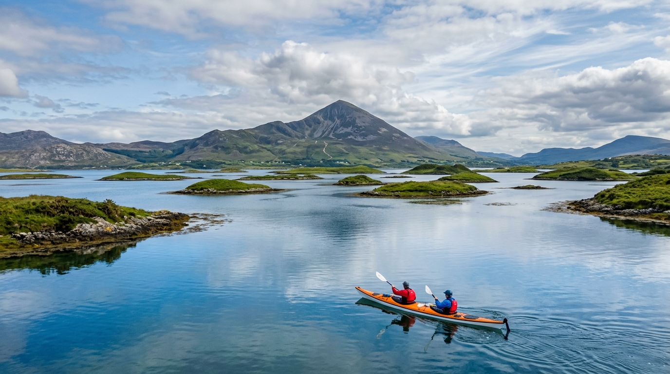
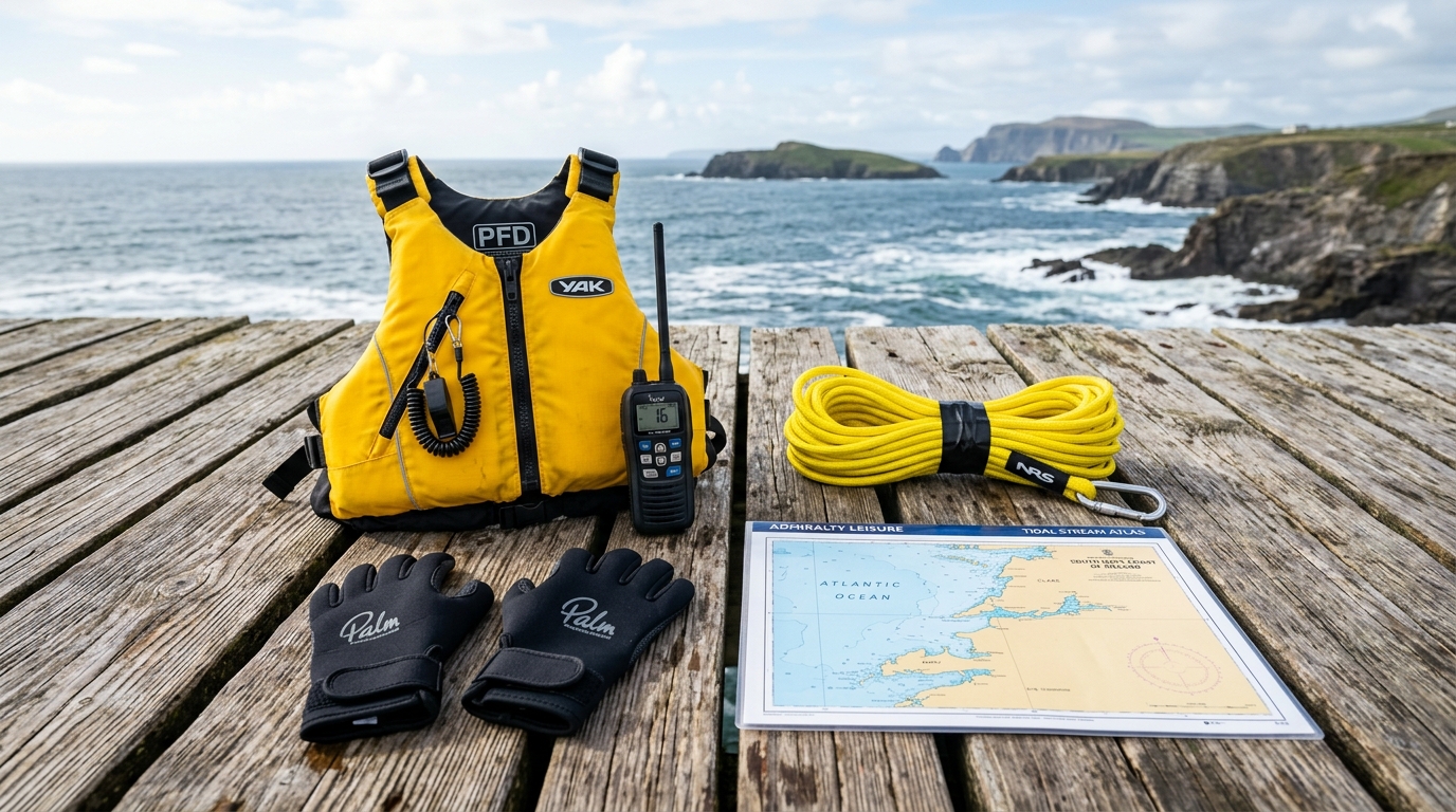
Navigation here requires care. The drumlin islands are remarkably similar in appearance from the water — low, rounded, grass-covered — and it is genuinely easy to become disoriented among them. Carry a laminated Admiralty chart of Clew Bay (Chart 2667) and a compass, and take a bearing before you enter the interior channels. The Inishgort Lighthouse on the southern edge of the bay is a useful landmark for orientation.
The tidal channels between the islands carry currents of up to 3 knots during spring tides. This is not dangerous for competent paddlers, but it will slow your progress significantly on the wrong state of tide. Aim to work the flood tide going north and the ebb coming south, keeping the current with you rather than against you.
- Skill Level: Novice to Intermediate.
- Launch: Westport Quay or Murrisk Pier.
- Wildlife: Common seals, oystercatchers, curlews, the occasional bottlenose dolphin in the outer bay.
2. Keem Bay Sea Kayaking (Achill Island)
Keem Bay is the flagship paddling destination on Achill Island, though its official Blueway there is a snorkel trail rather than a kayaking route — the sea kayaking described here is unmarked water for experienced paddlers only. The bay itself is a horseshoe of white sand enclosed by the steep slopes of Croaghaun — a perfect natural amphitheatre. Launching from the beach, conditions inside the bay are relatively sheltered.
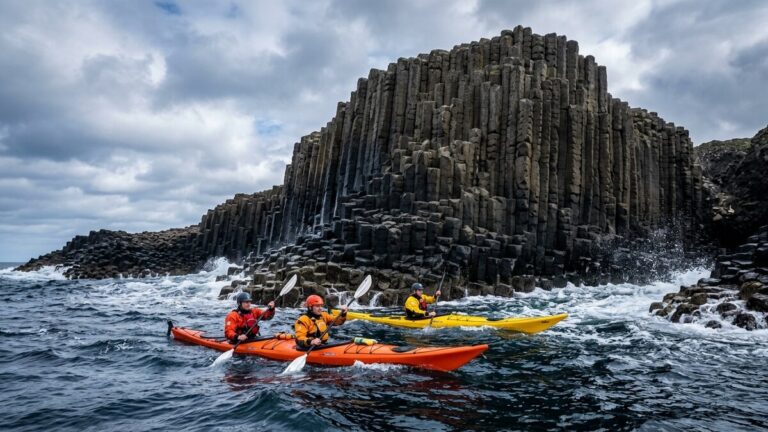
Once you round the headland and head west along the cliffs, the environment changes dramatically. The sea cliffs here rise vertically from the ocean, and the swell from the open Atlantic creates powerful surge along the cliff base. The scale of Croaghaun from the water is extraordinary — at 688 metres, this is one of the highest sea cliffs in Europe, and the vertical perspective from a kayak sitting 5 metres above the waterline is unlike anything on land.
The commitment: There are no landing spots once you leave the shelter of Keem Bay heading west. This is an advanced route. The groundswell at this section of coast is relentless. Guided tours from local operators are available and strongly recommended for anyone below Level 4.
- Skill Level: Advanced (self-guided). Intermediate (guided tour).
- Launch: Keem Bay beach.
3. Dugort Blueway Trail (North Achill)
The northern coast of Achill between Silver Strand and the beaches at Dugort is a second official Blueway route and one of the hidden gems of Mayo paddling. The route passes beneath dramatic cliff faces and into a series of deep sea caves carved into the rock by centuries of Atlantic swell.
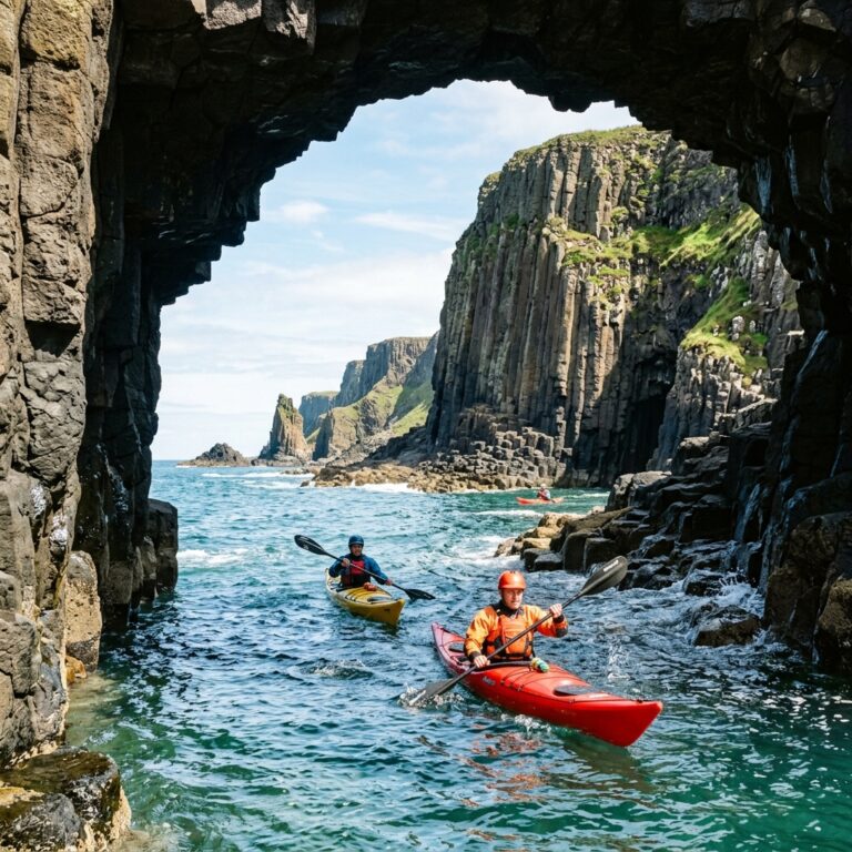
The sea caves at Dugort are the most accessible on Achill — on a calm day with low swell, they can be entered in a sit-on-top kayak under guided supervision. Inside, the sound of the surge, the dripping cave walls, and the colonies of nesting seabirds create an experience unlike anything above the waterline.
This route is weather-dependent. It should only be paddled when the swell height is below 1 metre and the wind is from the south or south-east. A northerly or north-westerly swell turns this coast very rough.
- Skill Level: Intermediate (guided). Advanced (independent).
- Wildlife: Grey seals, guillemots, razorbills, storm petrels.
4. Keel Lake (Beginner Base on Achill)
When the ocean is too rough for coastal paddling — which is often — Keel Lake (also called Keel Lagoon) is where beginners and improvers should go. This shallow, sandy-bottomed lake sits directly behind Keel Beach, separated from the Atlantic by a narrow sand bar. It is sheltered from ocean swell and from the steepest coastal winds, though strong onshore gusts can still reach the water.
The lake is small and generally calm, making it a good spot for learning basic paddle strokes, practising capsize recovery, and introducing children to kayaking. As with any open water, check conditions and supervise closely. Several operators on Achill offer sit-on-top hire on Keel Lake. It is also a good spot to test your gear before committing to the exposed coast.
- Skill Level: Absolute Beginner.
- Season: April to October.
5. The River Moy (Inland Alternative)
When the coast is too rough for sea paddling, the River Moy running through Ballina on the eastern side of the county offers a freshwater alternative. The Moy is famous for salmon fishing, but its lower reaches from Ballina Quay southward offer a peaceful, tree-lined river paddle, sheltered from coastal wind and swell. River level, flow and local fishing activity still need checking before you launch, though.
The current is gentle, the banks are heavily wooded, and the river passes through unspoiled countryside before widening into the Moy Estuary approaching Killala Bay. This is a solid intermediate paddle when the coast is closed, provided you check river level, flow and any local hazards first.
- Skill Level: Novice to Intermediate.
- Season: Year-round (though high water in winter makes the lower river run faster).
5. How to Execute the Clew Bay Island Route
A well-planned Clew Bay paddle from Westport Quay is one of the most satisfying day trips in the west of Ireland. Here is how to do it properly.
- Tidal Timing: Check the tide tables for Westport before you go and time your launch so the tide is working with you rather than against it. A rising tide into the bay and a falling tide on your return is the general pattern, but confirm timing and direction against a current tide table or chart on the day, not a fixed rule.
- Navigation: Take a bearing to Inishgort Lighthouse before you leave the quay. This lighthouse is visible from most points in the southern bay and gives you a reliable reference. Among the drumlin islands, take regular compass bearings and note which islands you have passed.
- Current Awareness: Where channels narrow between islands, the tidal flow speeds up. If a current feels too strong, cross it at 90 degrees to minimise your time in it, rather than trying to fight it from the side.
- Group Minimum: Clew Bay is not a solo paddling destination. The islands are remote, mobile phone coverage is patchy, and the tidal currents require group management. Paddle in a minimum group of three.
- Return Window: Leave yourself at least 2 hours of daylight on return. Navigation is harder in fading light among identical-looking islands.
6. What Can Go Wrong: The Real Risks in Mayo
- Atlantic Groundswell in Sea Caves: The Dugort caves and the Keem Bay cliffs amplify ocean swell. Even a 1-metre swell outside the cave can translate to 2–3 metre surge inside. This can throw a kayak against the cave wall without warning. Never enter a cave in anything other than very calm conditions, and always check the surge cycle before committing.
- Disorientation in Clew Bay: Every drumlin island looks the same from the water. This is a documented and frequent problem for visiting paddlers. Without a chart and compass, it is very easy to spend an extra hour paddling in the wrong direction. GPS apps on a phone are useful but unreliable with flat or dead batteries.
- Tidal Races at the Achill Sound: The narrow channel between Achill Island and the mainland at the Achill Sound carries powerful tidal currents around the bridge and the headlands to the north. Paddlers who approach this area without understanding the tidal schedule can be caught in fast-moving water that is very difficult to paddle against.
- Offshore Winds: If the wind is blowing from the east (offshore), it can feel deceptively calm at the beach. As you paddle west or south toward Keem Bay, the wind builds and can make the return journey extremely tiring or impossible for less experienced paddlers.
7. What to Avoid: Common Mistakes on the Mayo Coast
- Checking Only the Wind, Not the Swell: The wind forecast and the swell forecast are two different things. A flat wind forecast does not mean flat seas. A remote Atlantic storm 2,000 km away can send a 2–3 metre groundswell to the Achill coast without any local wind at all. Always check the Met Éireann Shannon Coastal Waters swell forecast before launching on the coast.
- Treating Clew Bay Like a Lake: Clew Bay looks sheltered on a map, but the outer islands are exposed to south-westerly fetch across the bay. In a Force 4 south-westerly, the southern bay builds significant chop that can overwhelm a sit-on-top kayak. Beginners must stay in the inner bay near Westport Quay.
- Paddling Alone on Achill: The coastal routes on Achill are remote. Mobile coverage disappears at the base of the Croaghaun cliffs. A marine VHF radio (Malin Head Radio, Channel 16) is the most reliable way to reach the Irish Coast Guard on this coast. Where you do have a signal, 112 or 999 also reaches the Coast Guard, but don’t treat a phone as your only backup out here.
8. Financial Breakdown: The Cost of Kayaking in Mayo
Mayo’s guided kayak operators, including Achill Surf Adventure Centre at Keel and Kayak le Tómas on Achill Island, price tours on request rather than publishing a fixed rate online — contact them directly for a current quote before you travel. One operator that previously ran kayak tours from Clew Bay, Saoirse na Mara, has closed after 13 years in business, so don’t rely on older listings that still mention it.
If you bring your own kayak, launch costs in Mayo are minimal — the slipways at Murrisk and Westport Quay are free, and Keem Bay has a car park with a small seasonal charge. The Dugort beach access is free.
9. What Comes Next: The Wild Atlantic Way by Kayak
Mayo sits at a critical junction on the Wild Atlantic Way. Heading north from Achill, the coast runs through the remote islands and headlands of north Mayo toward Killala Bay and eventually into Sligo and Donegal. This stretch — particularly the north Mayo coast from Belmullet to Killala — is some of the wildest, most committed sea kayaking territory in Ireland, largely unpaddled by visiting kayakers. It requires expedition planning and local knowledge.
Heading south from Clew Bay, the coast enters County Galway and the stunning paddling grounds of Killary Fjord and Connemara. Our full guide to Kayaking in Galway covers these southern routes in detail.
Frequently Asked Questions
Is kayaking safe for beginners in Achill Island? Yes, on Keel Lake. The lake is sheltered from Atlantic swell and is where local operators run beginner sessions and sit-on-top hire, though wind and weather still matter. The coastal routes around Achill — Keem Bay and Dugort — are not suitable for beginners without a qualified guide.
Do I need my own kayak to paddle in Mayo? No. Several operators on Achill Island offer sit-on-top hire on Keel Lake and guided tours to the sea caves and Blueway routes. For Clew Bay, operators in Westport run half-day and full-day island tours. However, having your own sea kayak gives you the flexibility to plan your own route on any given day based on conditions.
What is the water temperature in Clew Bay? Clew Bay is slightly warmer than the exposed Atlantic coast, reaching around 16–17°C in late summer due to its sheltered nature and shallower depth. The open Atlantic off Achill stays cooler — around 14–15°C in August. A 3mm or 4mm wetsuit is recommended for summer paddling in both locations.
Can I kayak to Clare Island from Westport? Clare Island is at the outer edge of Clew Bay, approximately 5 km from the nearest mainland point at Roonagh Quay. The crossing is exposed to south-westerly winds and swell, and tidal streams can run strongly at the mouth of the bay. Check a current tide table or chart before you commit. This is a committing intermediate-to-advanced crossing, not a day trip for beginners. A regular passenger ferry runs to Clare Island from Roonagh Quay if you want to visit without paddling the crossing.
Are there guided tours of the Dugort sea caves? Yes. Several operators on Achill Island run guided sea cave tours from the northern coast. These tours only operate when swell height is below the safe threshold, so bookings may be rescheduled in rough weather. Always book tours in advance during July and August as they fill up weeks ahead.
What emergency services cover the Achill coast? The Irish Coast Guard responds to marine emergencies off the Achill coast. The Malin Head Marine Rescue Sub-Centre (MRSC) coordinates rescues in the area, working with the Achill Island Coast Guard and Westport Coast Guard units locally. VHF Channel 16 is the emergency channel — always carry a marine VHF radio on the exposed coast. Mobile coverage at the base of the Croaghaun cliffs is extremely limited.

No comments yet on this guide.
Be the first to share your experience — conditions, access, hazards, or anything a future paddler should know.
Login to join the discussion