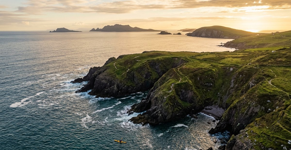
Kerry has Ireland’s fifth-longest county coastline — behind Cork, Mayo, Donegal and Galway — and almost all of it faces straight into the open Atlantic. Two full peninsulas — Dingle and Iveragh — reach out into the ocean either side of Dingle Bay, a third smaller one (Beara) forms the county’s southern edge, and in between sits Kenmare Bay, the Skellig coast, and a scatter of islands that most visitors only ever see from a tour-boat window. This guide covers the paddling geography of that coast: Dingle Harbour’s sea caves and cliffs, the Ring of Kerry’s chain of bays and headlands, Kenmare Bay’s sheltered inner water, and the Skellig coast around Portmagee and Valentia Island.
It does not cover Killarney. The lakes, Ross Castle and the National Park are their own destination, already covered in full in Kayaking Killarney and Kayaking Killarney Lakes — freshwater lake paddling, a different trip entirely from the coastal kayaking in this guide. If a search for “kayaking kerry” brought you here looking for Ross Castle and the lower lake, those are the guides you want.
If you want operators and prices first, skip to the operators and hire section below. Otherwise start with the four zones.
The Four Zones at a Glance
Kerry’s coastal paddling geography splits naturally into four areas: Dingle Peninsula in the north, the Ring of Kerry coast running around Iveragh, Kenmare Bay tucked in behind the Beara border, and the Skellig coast around Portmagee and Valentia Island at Iveragh’s western tip.
Zone 1 — Dingle Peninsula is advanced sea kayaking territory — cliffs, sea caves and a resident dolphin population, launching from Dingle’s sheltered inner harbour.
Zone 2 — Ring of Kerry Coast is the most varied zone in this guide, running from the sandspits of Castlemaine Harbour through the sheltered beaches of Derrynane to the exposed reaches of Ballinskelligs Bay.
Zone 3 — Kenmare Bay is the calmest water in this guide, a long sheltered sea inlet with a mild microclimate and seals that are regularly spotted, though never guaranteed.
Zone 4 — Skellig Coast covers Portmagee, Valentia Island and Caherciveen — the launch point for licensed boat tours to Skellig Michael, and a serious stretch of open Atlantic water in its own right.
| Zone | Difficulty | Water | Beginners OK | Best Season | Access |
|---|---|---|---|---|---|
| Zone 1 — Dingle Peninsula | Advanced | Exposed sea cliffs, sheltered harbour | Guided only | Apr–Sep | Irish Adventures |
| Zone 2 — Ring of Kerry Coast | Beginner–Advanced (varies by spot) | Mixed — sheltered beaches to open bay | Yes at Derrynane, Waterville | Apr–Oct | Derrynane Sea Sports, Sea Synergy, Skellig Watersports |
| Zone 3 — Kenmare Bay | Beginner–Intermediate | Sheltered sea inlet | Yes (guided) | Apr–Oct | Emerald Outdoors, Parknasilla |
| Zone 4 — Skellig Coast | Intermediate–Advanced | Harbours sheltered, open coast exposed | Yes inside Valentia Harbour (guided) | May–Sep | Valentia Island Sea Sports |
Zone 1 — Dingle Peninsula
Dingle Harbour, on the peninsula’s south side, is the launch point — an inner harbour sheltered by the long arm of the harbour wall, and the most convenient put-in for the coastal loop that runs out towards Eask Tower. Bottlenose dolphins are frequently spotted right at the harbour mouth. Fungie, the famous resident dolphin, was a fixture here for over thirty years until his disappearance in 2020, and other dolphins from the wider Shannon Estuary population are now regular visitors.
Once clear of the harbour, the coast turns south-west towards Eask Tower, a curious 19th-century stone structure built on the hilltop above to guide ships into the harbour. The cliffs below it drop sixty metres to the water, and this is where the trip stops being casual: the coast is fully exposed to Atlantic swell from the south-west, and the headlands create tidal races and clapotis — the confused, bouncing wave pattern where swell reflects off cliff faces — that can catch even experienced paddlers off guard. Timing matters. Launch on a rising tide, ideally in the morning before the sea breeze builds, and check the wind direction as well as its strength — an offshore wind on this stretch can carry a paddler out rather than back in.
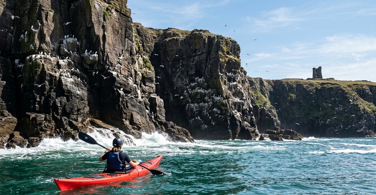
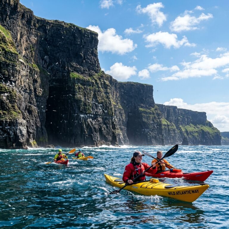
The cliffs between Eask Tower and Crow Rock host nesting razorbills, guillemots and fulmars from April to July, and several sea caves indent the coastline — whether they’re worth entering depends on swell, surge, tide state and wind on the day, and local knowledge matters more than the tide clock alone. The Blasket Islands are visible on the horizon to the west throughout, and on the return leg the views north across Dingle Bay to the Slieve Mish Mountains are excellent. The full loop runs to roughly twelve kilometres and needs a minimum of three hours — but conditions should be monitored constantly. If the forecast deteriorates, cut the route short and return through the harbour mouth.
Irish Adventures, based in Burnham just outside Dingle town, runs the main guided sea kayaking product on this stretch — a half-day trip along the harbour and coastline taking in the wildlife, cliffs and sea caves, plus a sunset version on calmer evenings. The operator has run tours here since 2007.
A word on Brandon Bay, on the peninsula’s north side: it isn’t part of this guide, and for good reason. Brandon Bay is one of Ireland’s best-known windsurfing and kitesurfing destinations — wide open to the north and northwest, reliably windy for most of the year, and marine guidance for the bay specifically advises it is “best avoided if there is any likelihood of bad weather approaching.” Stradbally beach, inside the bay, has documented strong and dangerous currents. The only kayaking that actually happens there is club-level surf kayaking by Kerry Canoe Club, who check surf forecasts and webcams before going — treated as a surf-conditions activity, not a recreational paddle. If you’re looking for sheltered kayaking on the Dingle Peninsula’s north side, the operators point instead to Dingle Harbour, Ventry Harbour and Smerwick Harbour on the south and west, all named as genuinely sheltered spots — not Brandon Bay.
Key logistics — Zone 1:
- Guided: Irish Adventures, Burnham, Dingle — irishadventures.ie — +353 87 419 0318
- Difficulty: Advanced (guided); full Atlantic swell exposure on the open stretch, sheltered inside the harbour
- Landmarks on the water: Eask Tower, sea caves between Eask Tower and Crow Rock, Blasket Islands on the horizon
- Hazard: Tidal races and clapotis at the headlands; full exposure once clear of the harbour
- Season: April–September, morning launches preferred
- Not covered here: Brandon Bay (north side) — a wind/kite/surf destination, not a recreational kayaking one
Zone 2 — Ring of Kerry Coast
The Iveragh Peninsula’s coast, outside Kenmare Bay and the Skellig area (both covered separately below), runs through four distinct stretches — each with its own character and its own set of hazards.
Rossbeigh, Glenbeigh and Cromane — Castlemaine Harbour
Rossbeigh Strand, near Glenbeigh, is a Blue Flag sandy spit projecting into Dingle Bay — one of three sandspits, with Cromane and Inch, that act as natural barriers protecting Castlemaine Harbour from the open Atlantic. It has taken a real battering from the sea: a winter 2008 storm breached the spit, and the breach has continued to widen since. Kayaking, windsurfing, paddleboarding and kitesurfing are all practised off the beach, and the adjoining mudflats are a genuine birdwatching spot.
A documented touring route runs from Kells Beach across to Cromane, crossing between the Rossbeigh and Inch sandbars — but this is expert-only water. Two tidal rivers converge at the gap between the sandbars, creating choppy surge conditions, and local operator guidance is to only cross between the sandbars at high tide. High tide alone doesn’t make the crossing safe — check the actual conditions on the day, not just the tide time.
Cromane, a fishing village on a peninsula jutting into Castlemaine Harbour just off the Ring of Kerry road, sits on the calmer southern side of the harbour, where small caves, inlets and rock arches make for gentler exploring. Castlemaine Harbour itself — including its salt marshes — is a Ramsar wetland site, Special Area of Conservation, Special Protection Area and National Nature Reserve covering roughly 2,281 acres, and one of the most important sites in southwest Ireland for wintering waterbirds. Sanderlings, oystercatchers and red-throated divers are all regularly reported here, alongside seals that will happily surface near a kayak.
Caherdaniel, Derrynane and Abbey Island
Derrynane Beach, at Caherdaniel on the N70, is the most straightforwardly beginner-friendly water in this guide outside Kenmare Bay — a Blue Flag beach roughly 1.5 kilometres long, inside Derrynane National Historic Park, and generally sheltered. Derrynane Sea Sports has operated here since 1984, over forty years now, in what the operator describes as the safe and sheltered waters of Derrynane Harbour — kayak rental with wetsuits included, and beginner tuition. That’s the operator’s own description, and conditions and paddler ability still matter more than the label.
One section of the beach is locally known as “Danger Beach,” for strong currents; it’s signposted, and lifeguards patrol it through summer. Just offshore, Abbey Island holds the ruins of Derrynane Abbey and a small graveyard — including the grave of Mary O’Connell, wife of Daniel O’Connell, whose family home, Derrynane House, overlooks the bay. The island is reached on foot across a sand causeway, but only at low tide; at high tide the causeway floods deep enough to strand anyone still out there. A lifeboat operated from Derrynane Beach as far back as 1844–1855, and today Derrynane Inshore Rescue — an independent charity founded in 1995 and a Declared Resource with the Irish Coast Guard — runs a 7-metre RIB from the same beach, a reminder that this stretch of coast has a real history behind its rescue cover.
Waterville and Lough Currane
Waterville sits on a narrow isthmus, with freshwater Lough Currane on its eastern side and the open Atlantic of Ballinskelligs Bay on its western side, linked by the short Currane River. The lough covers around 10 square kilometres and holds Church Island, an early medieval monastic site associated with the 7th-century St Finan Cam. Sea Synergy, based in Cahersiveen, runs a guided Church Island Kayaking Tour along the lough’s shores — sheltered freshwater paddling with none of the open-sea exposure hazards found elsewhere in this zone — though the operator’s own listing recommends some prior kayaking experience and needs a minimum of three people to run.
Ballinskelligs Bay
Ballinskelligs Bay is where the Ring of Kerry coast turns genuinely serious. A large, southwest-facing bay at the extremity of the Iveragh Peninsula, it is open directly to the prevailing swell direction, and conditions can turn highly uncomfortable in strengthened westerly-to-southerly winds. The bay is charted with real hazards worth knowing before you launch: Pig’s Rocks off Hog’s Head, a drying reef called Bullig off Horse Island, a rock awash at low water called Blue Boy, a shallow patch called Bay Rock, a drying ledge off Reenduff, a drying bar linking Horse Island to the mainland that’s impassable to craft, and submerged telegraph cables crossing the central bay.
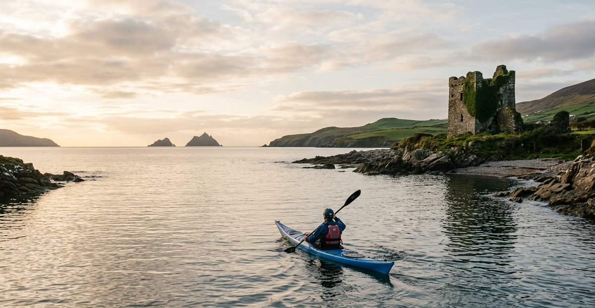
That said, the inner bay has a genuinely sheltered corner. Ballinskelligs Beach is a Blue Flag beach, described as fairly sheltered, with a full-time lifeguard service through July and August, and Skellig Watersports rents single and duo sea kayaks directly from the beach, describing the inner bay as “very safe” and sheltered from the open sea — the operator’s own assessment, and still worth checking against the day’s wind and swell rather than taking as a given. Sixteenth-century Ballinskelligs Castle, built by the MacCarthy Mór dynasty to guard the bay from pirates, still stands at the water’s edge — and the village was also the Irish landing point for an 1875 transatlantic telegraph cable run all the way from Nova Scotia, a distance of 2,565 nautical miles.
On a clear day, Skellig Michael and Little Skellig are visible offshore from Ballinskelligs, and Scariff and Deenish Islands — a pair of uninhabited islands just south of the bay, protected as a seabird Special Protection Area — sit close enough to see clearly from the water.
Key logistics — Zone 2:
- Guided/hire: Derrynane Sea Sports, Derrynane Beach, Caherdaniel — derrynaneseasports.com; Sea Synergy, Cahersiveen — seasynergy.org; Skellig Watersports, Ballinskelligs Beach
- Difficulty: Beginner at Derrynane, Waterville/Lough Currane and inner Ballinskelligs Bay (guided); Expert-only at the Rossbeigh–Inch crossing; open Ballinskelligs Bay is exposed water
- Landmarks: Abbey Island and Derrynane Abbey, Church Island on Lough Currane, Ballinskelligs Castle
- Hazard: Tidal surge at Rossbeigh–Inch (crossing only at high tide per local guidance, and even then conditions-dependent); multiple charted rocks and a drying bar in Ballinskelligs Bay; Abbey Island causeway floods at high tide
- Season: April–October for most operators; Ballinskelligs Beach lifeguarded July–August only
Zone 3 — Kenmare Bay
Kenmare Bay — technically the Kenmare River, though it’s a sea inlet rather than a true river — runs roughly fifty kilometres from Kenmare town out to the open Atlantic, between the Iveragh and Beara peninsulas. The inner bay, west of Kenmare town, is the sheltered section suitable for intermediate paddlers, and the pier on the south side of town gives a straightforward launch with parking nearby.
The Roughty and Sheen rivers enter the bay right at the pier, and the mixing of fresh and salt water creates rich feeding grounds: grey seals are seen on most trips, and bottlenose dolphins from the local Kerry population visit often through summer, though neither is ever a certainty. Paddle west from the pier along the southern shore, past Reen Point, and a series of small rocky coves backed by mature oak woodland opens up. Kenmare Bay’s microclimate is famously mild — the combination of Gulf Stream influence and mountain shelter supports strawberry trees, Mediterranean heathers and wild fuchsia hedges growing right down to the waterline. Cappul Island, about four kilometres west of the pier, makes a good turnaround point: a small beach on its eastern side, and a haul-out spot for seals.
The return along the northern shore passes Dunkerron Island and opens up views south towards the Caha Pass and Healy Pass on the Beara Peninsula. Tidal range in the inner bay is modest — around three metres — but the ebb produces a noticeable current in the narrows west of town, so check the tide state before setting out and time your paddle with the current rather than against it, whichever direction you’re headed.
This is Kerry-side water, but it’s shared with West Cork paddlers too — Kayaking West Cork links across to this same bay from the Beara side, since the two shores share the same estuary system and conditions.
Emerald Outdoors, based in Kenmare, runs guided kayak tours with Canoeing Ireland-qualified guides — a night trip (with a chance of bioluminescence on the right conditions), a morning tour and an afternoon tour, all around two to two and a half hours. Further down the bay near Sneem, Parknasilla Resort runs a guided sea kayaking trip straight from the resort’s own pier, with a safety briefing and basic instruction included, weather and tide dependent.
Key logistics — Zone 3:
- Guided: Emerald Outdoors, Kenmare — emeraldoutdoors.ie — +353 83 031 7011; Parknasilla Resort, Sneem — parknasillaresort.com — +353 87 947 4616
- Difficulty: Beginner–Intermediate; sheltered inner bay
- Landmarks: Cappul Island, Dunkerron Island, views to the Caha and Healy Passes
- Hazard: Noticeable ebb current in the narrows west of Kenmare town
- Season: April–October
Zone 4 — Skellig Coast
The far western tip of the Iveragh Peninsula — Portmagee, Valentia Island and Caherciveen — is Kerry’s most exposed and most rewarding coastal water, and it’s also the departure point for one of Ireland’s most tightly regulated tourist experiences: the boat crossing to Skellig Michael.
Portmagee, a small fishing village at the southwest tip of Valentia Harbour, connects to Valentia Island by a road bridge. Portmagee Marina is the main departure point for the licensed Skellig Michael boat tours, and once inside the harbour the water is well sheltered — though southwest gales should be avoided, since the sea gets genuinely violent under nearby Bray Head, with gusts that can be baffling and sudden off the surrounding high ground. Underwater hazards near the entrance include Anchor Rock, which uncovers at low water, and Scughaphort Reef, which needs a wide berth. Expect heavy commercial tour-boat traffic through the harbour roughly 9am to 7pm in season.
Valentia Island, reached via the Portmagee bridge or the seasonal car ferry from Reenard Point to Knightstown, gives complete shelter inside its main harbour entrance in reasonable conditions — but the advice flips in a northwest gale, when heavy seas break right across the harbour’s northern entrances and Portmagee becomes the safer option instead. Valentia Island Sea Sports, based in Knightstown, runs guided kayak tours (participants aged eleven and up) out to Beginish Island and coves that aren’t reachable by land, with wetsuit hire available.
Caherciveen, about two miles upriver from Valentia Harbour on the Valentia River, has a town pier and slipway usable for small-craft launching, and serves as the common land base for exploring this whole area.
Skellig Michael — what a kayak crossing actually involves
Skellig Michael sits about twelve kilometres out in open Atlantic water. The official, sanctioned way to visit is a licensed boat tour: roughly fourteen to fifteen boats currently hold an OPW landing permit, each making one landing per day with a maximum of twelve passengers, capping the whole island at somewhere around 180 visitors a day through a season that runs from mid-May to the end of September — and up to 40% of scheduled days get cancelled outright for sea conditions. Little Skellig, the neighbouring island, is a statutory Nature Reserve and Special Protection Area protecting a gannet colony of more than 30,000 breeding pairs — landing there is prohibited, full stop, and it can only be seen from the water.
Kayaking there independently is a different story. Heritage Ireland is explicit that access to Skellig Michael is only available through boat operators who hold a landing permit, with no carve-out in that guidance for kayaks or other private craft. Documented independent sea-kayak crossings exist in paddling circles, but they sit outside the permitted-access system the island is actually managed under, not inside some grey area of it. WaterEgo isn’t going to set out a route or encourage a landing the managing body doesn’t sanction. If you want to see Skellig Michael and Little Skellig, the licensed boat tour is the way to do it.
What’s not in question is the difficulty. Even the licensed boats describe the landing at Skellig Michael’s quay as subject to near-constant surge, with the crossing itself fully exposed to open Atlantic swell the whole way — there’s no intermediate shelter once you’re committed, and the only options are the mainland coast behind you or that one small quay ahead, itself busy with commercial tour boats through the middle of the day in season. This is expert-only water, strictly weather-dependent, and not a trip to add on casually to a Portmagee visit. For most paddlers, the sensible way to see Skellig Michael and Little Skellig is from a licensed tour boat, or from a kayak that stays well inside the mainland coast and admires them from a distance.
Key logistics — Zone 4:
- Guided: Valentia Island Sea Sports, Knightstown — valentiaislandseasports.com
- Difficulty: Intermediate inside the harbours (guided); Advanced/expert-only for any open crossing toward the Skelligs
- Landmarks: Skellig Michael and Little Skellig visible offshore on a clear day
- Hazard: Northwest gales close Valentia Harbour’s northern entrances; southwest gales make Portmagee’s Bray Head approach dangerous; a Skellig Michael crossing is a full open-ocean passage, and Heritage Ireland permits landing only through licensed boat operators, not independent or private craft
- Season: May–September; licensed Skellig Michael boat season runs roughly mid-May to end September, weather permitting
Wildlife on the Water
This is one of the richest wildlife coastlines in Ireland to paddle. Bottlenose dolphins are near-resident at Dingle Harbour’s mouth, and the wider Shannon Estuary population regularly passes through. Grey seals are seen on most trips in Kenmare Bay, hauling out on Cappul Island, and turn up often around Derrynane and the sheltered coves of the Ring of Kerry too — never guaranteed, but a regular sight. The cliffs between Eask Tower and Crow Rock on the Dingle side host nesting razorbills, guillemots and fulmars from April to July — a genuine seabird colony experienced from water level, which is a completely different thing to viewing it from a clifftop.
Castlemaine Harbour, protected as a Ramsar site and Special Protection Area, is one of the most important wintering waterbird sites in southwest Ireland — sanderlings, oystercatchers and red-throated divers among them. Further west, Little Skellig holds one of the largest gannet colonies on earth, over 30,000 breeding pairs, visible (though never landable) from a kayak that gets close enough on a calm day. Scariff and Deenish Islands, off Ballinskelligs Bay, add another protected seabird site to the same stretch of coast.
Getting There
Kerry is reached via the N21/N22 from Limerick and Cork, or the N70/N71 Ring of Kerry road that loops the whole Iveragh Peninsula. Kerry Airport, near Farranfore, has domestic and UK/European connections and sits roughly midway between Killarney and Tralee — about forty minutes from Dingle town and around an hour from Portmagee or Kenmare.
Within the county: Dingle town is about an hour from Killarney via the N86; Killorglin, on the Ring of Kerry road, is the turn-off point for Rossbeigh and Glenbeigh; Caherdaniel and Waterville sit further round the N70 loop, roughly ninety minutes from Killarney; Kenmare is reached via the N71 from Killarney (about 35 minutes) or the N70 from the Ring of Kerry side; and Portmagee, Valentia Island and Caherciveen sit at the far western end of the Ring, best reached via the N70 through Waterville — allow a full day if you’re planning to circle the whole peninsula rather than heading straight to one spot.
Tides, Weather and Safety
Licence and Legal Requirements
No licence or registration is required to sea kayak in Ireland. Canoeing Ireland, the sport’s national governing body, confirms there’s no legal licensing requirement for recreational kayaking. The one hard legal requirement is equipment, not paperwork: a suitable, CE/ISO-certified personal flotation device must be worn while kayaking under Irish law, and its rating needs to match the water — a basic 50N buoyancy aid is fine close to shore, but the exposed stretches of this coast call for a higher-rated PFD suited to open, rough water. Training through Canoeing Ireland’s Skills Awards, and club membership (which bundles accident and liability insurance), are strongly recommended but not mandatory.
Tides
Kenmare Bay’s inner section runs a tidal range of around three metres, with a noticeable ebb current in the narrows west of Kenmare town. Around Rossbeigh and Cromane, two tidal rivers converge at the sandbar gap into Castlemaine Harbour — local guidance is to cross only at high tide, and it’s expert-only water even then, with conditions on the day still deciding whether it’s sensible. Valentia Harbour and the Portmagee approach both carry real tidal current, and the shelter each offers flips depending on wind direction: Valentia is exposed to the north, Portmagee to the southwest. Ballinskelligs Bay’s outer hazards — rocks, reefs and a drying bar — are all tide-dependent; check a chart or local knowledge before venturing beyond the inner, lifeguarded section of the beach.
Weather
Met Éireann issues a Sea Area Forecast four times daily (00:00, 06:00, 12:00, 18:00), covering Irish coastal waters out to thirty nautical miles, with Small Craft Warnings attached when conditions turn. A Small Craft Warning is issued for Beaufort Force 6 winds — a sustained 22 knots or more — expected within ten nautical miles of the coast, which is the practical trigger point to stay off exposed water like the outer Dingle Peninsula, Ballinskelligs Bay or the Skellig crossing.
| Force | Wind (knots) | Kerry coast advice |
|---|---|---|
| F0–F2 | 0–6 | Dingle Harbour, Kenmare Bay, Derrynane and inner Valentia Harbour are usually workable, still check swell, tide and your own experience |
| F3 | 7–10 | Sheltered zones usually workable, but check swell and tide too. Experienced paddlers only on the open Dingle and Ballinskelligs coast, conditions depending |
| F4 | 11–16 | Inner-harbour spots only (Kenmare Bay, Portmagee, Derrynane), and only if swell and tide are also favourable. Open coast and any Skellig approach best avoided |
| F5+ | 17+ | Sheltered water only, in full lee, and only with a favourable forecast. Open-coast paddling isn’t advisable anywhere in this guide at this wind strength |
Safety Contacts
Marine Rescue Sub-Centre Valentia is the Coast Guard’s coordination centre for this entire coast — from Ballycotton in East Cork to Clifden in Galway, which takes in every zone in this guide. It monitors VHF Channel 16 (and Channel 24/MF 1752 kHz specifically for Valentia traffic); phone +353 66 947 6109, or dial 999 or 112 and ask for the Coast Guard. Valentia RNLI, based at Knightstown, runs an all-weather lifeboat covering the challenging southwest Kerry coast, including the Iveragh Peninsula and the Skellig approaches. Fenit RNLI, north of the Dingle Peninsula, covers Tralee Bay and the Shannon Estuary approaches. Derrynane Inshore Rescue, an independent charity and Declared Resource with the Irish Coast Guard, runs its own RIB from Derrynane Beach, serving the Kenmare River area and southwest Kerry waters.
There is no Marine Casualty Investigation Board report specific to sea kayaking on this coast — but treat that as a gap in the record, not a sign the water is safe. Real Coast Guard call-outs on this stretch include a trawler grounding near Dingle in December 2025 that needed the Shannon-based rescue helicopter, and a drifting paddleboarder rescued near Valentia in November 2024. Both are a reminder that conditions here turn serious fast, for boats and paddlers alike.
Season by Season
January to March — Wintering birds are at their best around Castlemaine Harbour. Most tour operators are closed; this is not the season to attempt anything on the exposed Dingle or Skellig coasts.
April to May — The season opens. Irish Adventures, Derrynane Sea Sports and Emerald Outdoors begin their main hire windows; the Skellig Michael licensed boat season typically starts in mid-May, weather permitting.
June to August — Peak season across the county. All operators in this guide run their full schedules; Ballinskelligs Beach gets its full-time lifeguard cover; nesting seabirds are active on the Dingle cliffs into July.
September — A quieter, still-warm window. Good conditions across most zones; the Skellig Michael boat season runs to the end of the month.
October to December — Most seasonal operators close for the year. The sheltered inner waters — Kenmare Bay, Derrynane, inner Valentia Harbour — can still work with a guide on a genuinely calm day, but check actual conditions and get qualified local advice rather than assuming shelter alone is enough; open-coast and any Skellig-area paddling should wait for spring.
Operators, Hire and Lessons — 2026
Kerry’s coastal operators split by zone: Dingle Peninsula has one dedicated sea kayak operator, the Ring of Kerry has three spread across its length, and Kenmare Bay has two. This guide’s sister article, the Kayak Rental Cork & Kerry guide, covers hire pricing across the wider Cork-Kerry region in more depth — this table is the Dingle-to-Skellig coastal subset. Prices below were checked against each operator’s own current site or listing on 7 September 2026 — confirm directly with the operator before booking, since rates and seasons change.
Hire and Guided Sessions
Irish Adventures — the main sea kayaking operator on the Dingle Peninsula, running trips out of Burnham since 2007 along the harbour and coastline, taking in cliffs, sea caves and wildlife. A sunset version runs on calmer evenings.
- Launch: Burnham, Dingle | Price: Contact for current rates | Season: April–September | Website: irishadventures.ie | Phone: +353 87 419 0318
Derrynane Sea Sports — kayak rental with wetsuits included, plus beginner tuition, in the sheltered waters of Derrynane Harbour. Operating from Caherdaniel since 1984.
- Launch: Derrynane Beach, Caherdaniel | Price: Contact for current rates | Season: April–October | Website: derrynaneseasports.com
Sea Synergy — a guided Church Island Kayaking Tour on Lough Currane’s sheltered freshwater, based out of Cahersiveen, alongside the operator’s marine awareness work.
- Launch: Lough Currane, Waterville | Price: €73.70 adult (16+), €210.57 family (2 adults + 2 children), 2.5hr, minimum 3 people | Season: April–October | Website: seasynergy.org | Phone: +353 87 455 4034
Skellig Watersports — self-paddle single and duo sea kayak rental directly from Ballinskelligs Beach, in what the operator describes as very safe, sheltered inner-bay water.
- Launch: Ballinskelligs Beach | Price: Contact for current rates | Season: Summer, lifeguard cover July–August
Emerald Outdoors — Canoeing Ireland-qualified guided kayaking from Kenmare, with morning, afternoon and night trip options — the night trip carrying a chance of bioluminescence on the right conditions.
- Launch: Kenmare | Price: €65pp morning or afternoon tour (child €50, age 8–15); €75pp night trip (child €50, age 8–15); 2–2.5hr | Season: April–October | Website: emeraldoutdoors.ie | Phone: +353 83 031 7011
Parknasilla Resort — a guided sea kayaking trip departing straight from the resort’s own pier near Sneem, with safety briefing and basic instruction, weather and tide dependent.
- Launch: Sneem | Price: €30 adult, €15 child, 1.5hr | Website: parknasillaresort.com | Phone: +353 87 947 4616
Valentia Island Sea Sports — guided kayak tours from Knightstown out to Beginish Island and coves not reachable by land, with wetsuit hire.
- Launch: Knightstown, Valentia Island | Price: Contact for current rates | Min age: 11 | Website: valentiaislandseasports.com
| Operator | Water | Model | Price (2026) | Season |
|---|---|---|---|---|
| Irish Adventures | Dingle Harbour | Guided half-day | Contact | Apr–Sep |
| Derrynane Sea Sports | Derrynane Harbour | Self-paddle hire | Contact | Apr–Oct |
| Sea Synergy | Lough Currane | Guided 2.5hr | €73.70/adult | Apr–Oct |
| Skellig Watersports | Ballinskelligs Beach | Self-paddle hire | Contact | Summer |
| Emerald Outdoors | Kenmare Bay | Guided 2–2.5hr | €65–75/adult | Apr–Oct |
| Parknasilla Resort | Kenmare Bay (Sneem) | Guided 1.5hr | €30 adult | Apr–Oct |
| Valentia Island Sea Sports | Valentia Harbour | Guided tour | Contact | May–Sep |
Elsewhere in the county but outside this guide’s scope: Wild Water Adventures runs from Fenit on Tralee Bay, north Kerry — a different stretch of coast to the Dingle-to-Skellig geography covered here. Killarney Kayaking and Outdoors Ireland both cover Killarney Lakes — see Kayaking Killarney and Kayaking Killarney Lakes for that side of the county.
For the full county-wide rental comparison, see the Kayak Rental Cork & Kerry guide.
Frequently Asked Questions
Do you need a licence to kayak in Ireland? No. There’s no legal licensing or registration requirement for recreational kayaking in Ireland. The one hard legal requirement is a suitable, CE/ISO-certified personal flotation device, worn while kayaking, with a rating that matches the water — more than the basic 50N minimum on exposed coastal stretches like this one. Training and club membership are strongly recommended but not mandatory.
Can you kayak to Skellig Michael? Not as a sanctioned way to land. Heritage Ireland states that access to Skellig Michael is only available through boat operators who hold a landing permit, and that guidance doesn’t carve out an exception for kayaks or other private craft. It’s also a serious, fully-exposed open-ocean crossing with a difficult landing even in calm weather. For seeing Skellig Michael and Little Skellig, the licensed boat tour is the sanctioned option.
Where can I go kayaking in Killarney? Killarney’s lakes are covered separately — see Kayaking Killarney for the main guide and Kayaking Killarney Lakes for a deeper, seasonal look at the same water. This guide covers Kerry’s coast — Dingle, the Ring of Kerry, Kenmare Bay and the Skellig coast — not the lakes.
Is Brandon Bay good for kayaking? Not really. Brandon Bay, on the north side of the Dingle Peninsula, is one of Ireland’s best windsurfing and kitesurfing destinations, wide open to the north and reliably windy — exactly the conditions that make it a poor kayaking spot. Marine guidance for the bay specifically advises avoiding it if bad weather is possible, and the only real kayaking activity there is club-level surf kayaking. For sheltered paddling on the Dingle Peninsula, look to Dingle Harbour, Ventry Harbour or Smerwick Harbour instead.
What’s the best place to kayak in Kerry for beginners? Derrynane Beach at Caherdaniel, Lough Currane at Waterville, and the inner section of Kenmare Bay are the three most consistently beginner-friendly spots in this guide — all sheltered, all with a guided or hire option, and none of them carrying the open-Atlantic exposure of the Dingle or Skellig coast.
Is Dingle good for kayaking? Yes, but it’s a guided, advanced-water trip rather than a casual paddle. Dingle Harbour itself is sheltered and a fine launch point, but the coastal route out towards Eask Tower and the sea caves is fully exposed to Atlantic swell, with real tidal races at the headlands. Irish Adventures runs the main guided trip.
Is there kayaking near Kenmare? Yes — Kenmare Bay is the most sheltered water in this whole guide, a long, calm sea inlet with a mild microclimate, grey seals seen on most trips and dolphins that visit often, though wildlife sightings are never guaranteed. Emerald Outdoors runs guided tours from Kenmare town itself, and Parknasilla Resort runs a shorter trip further down the bay near Sneem.
Planning Your Trip — Summary
First-timers and families should start at Derrynane Beach, Lough Currane or inner Kenmare Bay — sheltered water, guided options, and none of the open-Atlantic exposure found elsewhere in this guide. Experienced paddlers looking for a real Wild Atlantic Way trip should book Dingle’s guided coastal route for the sea caves and cliffs, or explore Ballinskelligs Bay and the Portmagee/Valentia area with a guide who knows the tides and rock hazards. Anyone eyeing Skellig Michael should book the licensed boat tour rather than treat a kayak crossing as a given — Heritage Ireland limits landing access to permit-holding boat operators, and the crossing itself is serious, fully-exposed water. Whatever the plan, check the Met Éireann marine forecast, respect the Small Craft Warning threshold, and remember that Killarney’s lakes are a separate trip covered in their own guides.
Also Read
- Kayaking Killarney — Lakes, Rivers and the Ring of Kerry — the sibling guide covering Killarney’s lakes, not the coast covered here.
- Kayaking Killarney Lakes — Seasonal Tips — a deeper, seasonal look at the same lake water.
- Kayaking West Cork — Lough Hyne, Bantry Bay and the Mizen Peninsula — the neighbouring guide, sharing Kenmare Bay’s water from the Beara/Cork side.
- Kayak Rental Cork & Kerry — Rosscarbery to Kenmare — the dedicated hire directory for the wider region.
- Best Places to Kayak in Ireland — 16 Spots Rated and Mapped — the national list.
- Sea Kayaking Ireland — Complete Guide — national overview of conditions, gear and planning.
- Kayaking Clubs in Ireland — 45 Verified Clubs by County — the full club listing.
- Kayak Rental Ireland — 54 Verified Operators by County — the national hire directory this guide feeds into.

No comments yet on this guide.
Be the first to share your experience — conditions, access, hazards, or anything a future paddler should know.
Login to join the discussion