County Clare is one of the most geographically split counties in Ireland for kayaking. On the western edge, the Atlantic batters 200-metre limestone cliffs in conditions that demand serious sea kayaking experience. An hour’s drive east, Lough Derg and the River Shannon offer flat water that suits a complete beginner on a settled day. This guide covers both worlds in full — where to launch, what the water demands of you, what it costs, and exactly what can go wrong.
Whether you are an advanced paddler chasing the Cliffs of Moher sea caves or a family looking for a sheltered morning on the Shannon, this guide covers what you need for both.
1. Why Clare is One of Ireland’s Most Varied Paddling Counties
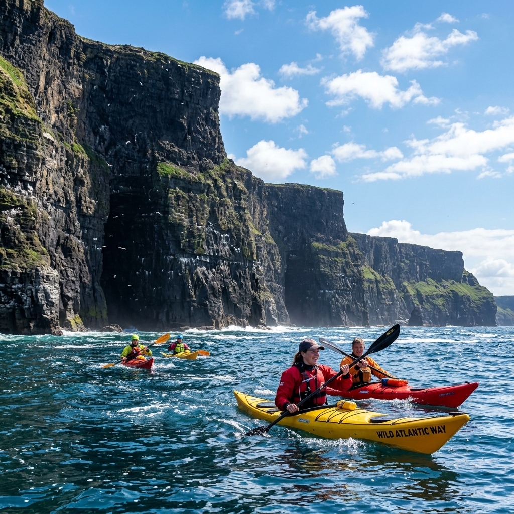
County Clare sits in a uniquely privileged position on the island of Ireland. It stretches from the Wild Atlantic Way in the west — one of the most exposed stretches of coastline in Europe — all the way to the calm, locked waters of Lough Derg and the River Shannon on its eastern border.
This means Clare pairs a committing 10 km sea kayak beneath the Cliffs of Moher in the morning with flatwater paddling near Killaloe by evening, all within the same county. The range of experience available here is extraordinary.
The Burren adds a third dimension entirely. This unique limestone karst landscape on Clare’s northern coast creates a coastline unlike anything else on the island — pale rock shelving directly into Galway Bay, creating crystal-clear, sheltered paddling conditions in the small bays around Ballyvaughan and New Quay.
2. Who Should Paddle in Clare?
Clare demands a careful honest assessment of your skill level before you launch, because the consequences of choosing the wrong location for your ability are severe on the western coast.
- Absolute Beginners (Level 1): Lough Derg near Killaloe is your destination. The lake is vast and sheltered from Atlantic swell, though its own length can still build a real chop in a strong wind, so check the Met Éireann forecast and stay close to shore until you know the conditions. Sit-on-top kayaks are well suited. The river approach near Killaloe town is slow-moving and forgiving.
- Novice to Intermediate Paddlers (Level 2–3): The northern Burren coastline around Ballyvaughan and New Quay is ideal. The coastline is sheltered from the worst Atlantic swells by the land mass to the north, and the tidal currents are manageable with basic planning.
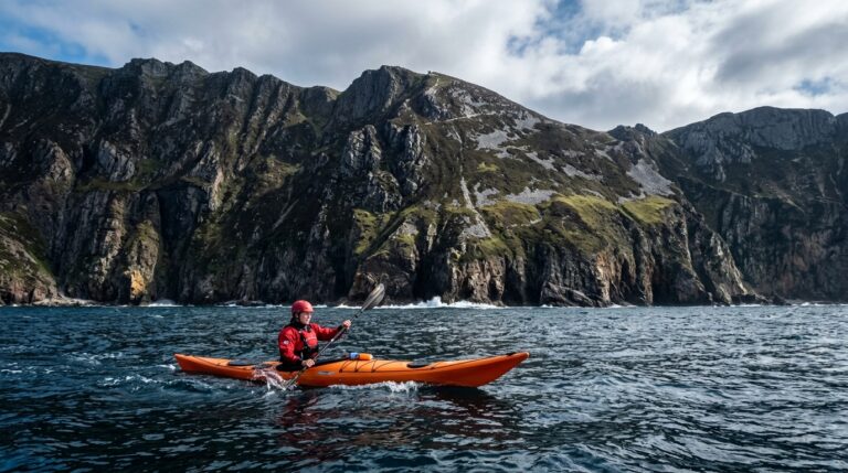
- Advanced Sea Kayakers (Level 4+): The Cliffs of Moher coast from Doolin south to Liscannor Bay is your arena. This is one of the most committed pieces of coastline in Ireland. There is no shelter, no landing, and the Atlantic groundswell runs unbroken for thousands of kilometres before hitting the cliff base.
3. When to Go: Seasons, Wind, and Tides
Timing is the difference between a transcendent paddle and a dangerous situation in Clare.
The West Coast Season
The safe window for the Cliffs of Moher and the Atlantic-facing coast is a narrow one: late May through early September, when high-pressure systems are most frequent and the average wind speeds drop. Even within this window, you must wait for the right day. Prevailing south-westerly winds in Ireland are an enormous factor. For coastal paddling in Clare, you want either a calm day or a light easterly or north-easterly wind, which presses the swell down at the cliff face rather than building it up. Match the direction to your actual route and return leg, though: the same offshore wind that flattens the swell can make the paddle back to your launch point exhausting or impossible if it strengthens during the day.
Lough Derg: Year-Round
Lough Derg is paddleable for much of the year. The water is at its warmest (around 17°C) from July to September, making it the most pleasant for beginners not wearing drysuits. In spring and autumn, the water temperature drops to around 10°C, and paddling in a wetsuit becomes essential. Winter paddling is possible for experienced club paddlers but not recommended for recreational visitors.
The Tidal Factor on the West Coast
The west Clare coast has a significant tidal range, and spring tides bring strong tidal currents around exposed headlands like Black Head (on the Burren coast) and the point south of Doolin. The exact range and current speed vary by location, so treat any single figure as a rough guide rather than a rule for the whole coast. Always carry a tidal atlas covering Loop Head and the Shannon Estuary approaches, and check local tide times before you commit to a route.
| Beaufort Force | Wind Speed (knots) | Atlantic Conditions | Recommendation for Clare Paddlers |
|---|---|---|---|
| Force 1–2 | 1 – 6 knots | Glassy, minimal swell | Good window for the Cliffs of Moher if wind direction and forecast also line up. Most locations suit the right skill level. |
| Force 3 | 7 – 10 knots | Gentle ripples, low swell | Cliffs route for advanced only. Burren coast good. |
| Force 4 | 11 – 16 knots | Moderate chop, 1m swell | Cliffs closed. Burren for experts. Lough Derg manageable if you stay near shore. |
| Force 5+ | 17+ knots | Heavy chop, spray | Stay ashore on the coast. Lough Derg only. |
4. The 5 Best Places to Kayak in Clare
1. The Cliffs of Moher Coast (Doolin to Liscannor)
This is the standout route in Clare and one of the most dramatic sea kayak journeys in Ireland. You launch from the small harbour at Doolin — a working fishing pier that requires careful attention to boat traffic — and paddle south. The cliffs begin almost immediately, building in height as you progress south toward the main Cliffs of Moher visitor area.
The perspective from the water is completely different from anything accessible to land visitors. You are sitting at water level, looking directly up at 200-metre vertical limestone walls. The cliff face is riddled with sea caves carved by centuries of Atlantic action, including one significant cave system accessible only from the water.
The sea stack Branaunmore — the Great Sea Stack — rises 67 metres directly from the ocean south of Doolin Pier. Paddling around its base, listening to the resident guillemots and razorbills, is an experience unique to this coastline.
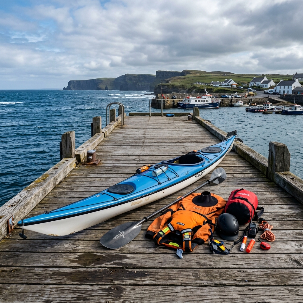
The hard reality: There are zero landing spots between Doolin and Liscannor Bay — approximately 12 km of coastline. If you have a problem, you cannot get out. You need a sea kayak with sealed bulkheads, a VHF radio on Channel 16 (Irish Coast Guard), a tow line, and a spray deck. This route is not open to guided sit-on-top tours on anything other than the calmest of days.
2. Lough Derg and Killaloe
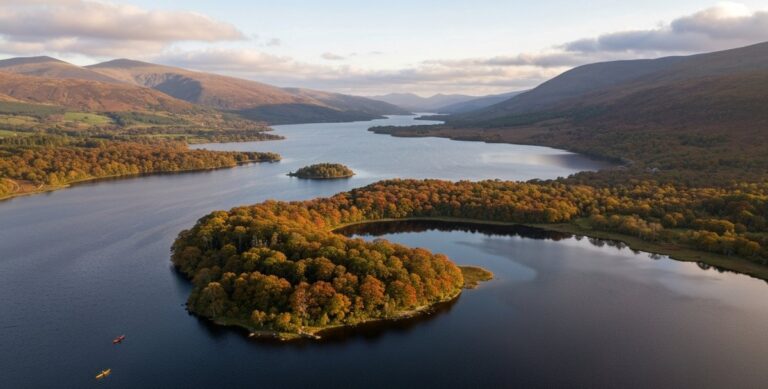
Lough Derg is Ireland’s third-largest lake and forms the natural border between Clare and Tipperary on the eastern side of the county. It is one of the finest beginner and family kayaking destinations in the entire country.
Launching from the stone slipway at Killaloe is straightforward. The town of Killaloe sits at the southern tip of the lake, where the lake narrows back into the River Shannon. You can paddle north into the main body of the lake, exploring wooded shorelines and the small islands near Mountshannon. The lake is broad enough to give you a genuine sense of open-water freedom, and a beginner in a sit-on-top kayak who checks the forecast and sticks close to shore will find it manageable and forgiving.
The water here is some of the cleanest in Ireland — Lough Derg is the primary drinking water supply for Limerick city. It is an excellent spot for wildlife watching: common terns nest on the islands in summer, and otters are regularly spotted along the reed-lined western shore.
- Skill Level: Absolute Beginner to Intermediate.
- Best Season: May to October.
3. The Burren Coast — Ballyvaughan and New Quay
The northern Clare coastline, where the limestone pavements of the Burren meet Galway Bay, is Clare’s hidden paddling gem. The pale grey rock shelves gently into exceptionally clear water, which takes on an almost Mediterranean turquoise colour on sunny days.
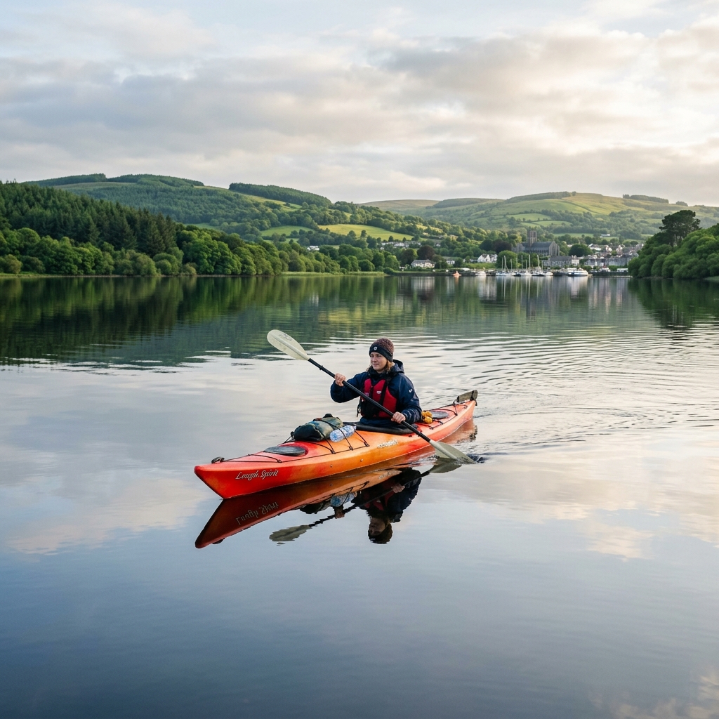
Launching from the small pier at Ballyvaughan or the slipway at New Quay, you can explore a wonderfully complex coastline of rocky headlands, hidden shingle beaches, and shallow limestone shelves. Sitting inside Galway Bay, this stretch takes the edge off the big Atlantic groundswell that hits the exposed coast to the south, though check the wind direction for the day before you commit to a route.
- Skill Level: Novice to Intermediate.
- Wildlife: Curlew, oystercatcher, grey seals in the tidal pools.
4. Lahinch and Spanish Point
The mid-Clare coast around Lahinch and Spanish Point is primarily known as a surfing destination, but it offers interesting kayak-surfing opportunities in the right conditions. The sandy beach at Lahinch provides an easy launch point, and the offshore reefs at Spanish Point attract some of Clare’s best surf breaks. Experienced surf kayakers will find challenging conditions here in autumn and winter when the Atlantic swells run big.
- Skill Level: Intermediate to Advanced.
- Vibe: Active, surf-focused, dynamic.
5. The River Fergus at Ennis
Less well known than Lough Derg or the coast, the River Fergus running through Ennis offers a pleasant town-centre paddle. The river is tidal in its lower reaches below Clarecastle and opens into the Shannon Estuary to the west of Shannon Airport. The upper stretches around Ennis itself are slow-moving and sheltered, making them suitable for beginners wanting to experience river paddling without driving to the coast.
5. How to Execute the Cliffs of Moher Route
If you are an advanced paddler planning the Cliffs of Moher route independently, meticulous execution is non-negotiable.
- Check Met Éireann’s Marine Forecast (Shannon Coastal Waters): You need a settled forecast. Force 3 maximum, no deterioration predicted during your paddle window. The cliff face reflects swell back outward, creating what is called “clapotis” — a confused, choppy sea state at the cliff base that is completely different from conditions 200 metres offshore. Even on a Force 2 day, the water at the cliff base can feel turbulent.
- Launch Time: Launch from Doolin 1 to 2 hours before high water on a neap tide. This gives you a gentle push south along the cliffs, minimising the tidal current you fight on the return journey.
- Communications: Share your passage plan before you launch. The SafeTrx app, developed with the Irish Coast Guard, lets you log your route and expected return time and can alert a shore contact if you do not check in. At minimum, leave your start point, intended route, and expected return time with someone ashore who knows to raise the alarm if you are overdue. In an emergency, call 112 or 999 and ask for the Coast Guard, or raise them directly on VHF Channel 16.
- Group Minimum: Never paddle this route solo. A minimum group of three is standard practice. If one paddler capsizes, one assists while the third maintains radio watch and calls for help if needed.
- Turnaround Rule: If at any point during the paddle the sea state feels more uncomfortable than predicted, turn around while you still can. There is no shame in it. Past the midpoint of the cliff section, though, pressing on to Liscannor may be safer and faster than fighting back against the tide — decide your realistic turnaround point before you launch.
6. What Can Go Wrong: The Real Risks in Clare
Clare’s risks are concentrated on the western coast but are serious and worth understanding in full.
- Clapotis at the Cliff Base: The reflected swell described above can flip an unwary paddler who approaches the cliff base too closely. The rule is to stay at least 50 metres from the base unless conditions are exceptional.
- Sea Caves and Surge: The sea caves in the Cliffs of Moher are spectacular, but tidal surge inside them is violent. A wave that looks small outside the cave entrance is compressed as the cave narrows, amplifying its power enormously. Never enter a sea cave alone, and always check the surge cycle before committing.
- Offshore Winds at Lahinch: If you are launching from a beach like Lahinch and the wind is blowing offshore (easterly), it may feel deceptively calm and sheltered at the water’s edge. But as you paddle further out, the wind will build and will make the return journey exhausting or impossible.
- Cold Water Shock: Even in August, the Atlantic off Clare does not exceed 16°C. A capsize without a wetsuit or drysuit leads to cold water shock within seconds and incapacitation within minutes.
7. What to Avoid: Common Mistakes on Clare Water
- Assuming the Inland Forecast Matches the Coast: The Met Éireann general weather forecast for Clare is based on land conditions. Wind speeds at sea are consistently higher, and the sea forecast (Shannon Coastal Waters area) is a completely different product. Always read the marine forecast, not the town weather.
- Launching at Doolin Without Checking the Harbour: Doolin Pier is an active fishing pier. Fishing boats have right of way. Do not launch when a boat is manoeuvring. The Aran Islands ferries also use the pier — their departure times are published online and you should know them.
- Underestimating Lough Derg’s Wind Fetch: Lough Derg is 39 km long. When a southerly or northerly wind blows along its length, waves build much larger than you would expect on an inland lake. Beginners should stick to the sheltered southern end near Killaloe and not attempt to cross the main body of the lake in anything above Force 3.
8. Financial Breakdown: The Cost of Kayaking in Clare
Clare is one of the more expensive counties for guided coastal kayaking, reflecting the specialist skills required on the Cliffs of Moher route. Inland options remain very affordable.
If you bring your own kayak, the only costs are fuel and the price of a car park at Doolin or Killaloe. The slipways at both locations are free to use. However, bringing your own kayak to the Cliffs of Moher route means you are responsible for your own safety assessment — no guide will pull you out if you misjudge the conditions.
9. What Comes Next: Where Clare Fits in the Bigger Picture
Clare sits between two world-class paddling counties on the map. The Loop Head Peninsula at Clare’s south-western tip is the final dramatic headland before the Shannon Estuary opens up. Crossing the estuary brings you into County Kerry and eventually the legendary sea kayaking grounds of the Dingle Peninsula and the Kerry Coast.
To the north, across the mouth of Galway Bay, the Aran Islands and the sheltered inlets of Connemara await. A kayaker following the Wild Atlantic Way by sea — an increasingly common multi-week expedition — would paddle the Clare coast as a critical connector between Connacht and Munster.
Frequently Asked Questions
Is kayaking to the Cliffs of Moher from Doolin safe? Yes, but only for advanced sea kayakers with proper equipment — a sea kayak with sealed bulkheads, a spray deck, a VHF radio, and experience reading Atlantic conditions. The route has no landing spots for 12 km. For beginners and intermediates, a guided tour from a qualified operator is the only safe option.
Can beginners kayak on Lough Derg in Killaloe? Absolutely. The waters near Killaloe are among the most beginner-friendly in Ireland. A sit-on-top kayak is ideal, and local rental operators in the town provide all the gear you need. Stick to the calmer southern end of the lake and stay close to shore until you build your confidence.
What is the water temperature in Clare? The Atlantic off Clare’s west coast ranges from 9°C in winter to around 16°C in August. Lough Derg peaks at approximately 17°C in late summer. A wetsuit is recommended for sea paddling year-round. A drysuit is recommended for winter paddling anywhere in the county.
Do I need a permit to kayak on Lough Derg? No permit is required to paddle a non-motorised kayak on Lough Derg. Separately, under the Merchant Shipping (Pleasure Craft) (Lifejackets and Operation) (Safety) Regulations, anyone in an open craft under 7 metres, a kayak included, must wear a suitable personal flotation device at all times while afloat — that legal requirement applies regardless of the permit question.
What is the best time of year to kayak the Cliffs of Moher? June, July, and August offer the most frequent windows of calm weather suitable for this route. You need to watch the Met Éireann Shannon Coastal Waters forecast and wait for a day with Force 2 or less, with no swell from the west exceeding 1 metre.
Are there kayaking clubs in County Clare? East Clare Paddlers, based at Scariff Harbour and Mountshannon on Lough Derg, is the primary club for the county, affiliated with Canoeing Ireland. Joining a club is the safest way for novice and intermediate paddlers to build skills under the supervision of qualified coaches before attempting the exposed coastal routes.

No comments yet on this guide.
Be the first to share your experience — conditions, access, hazards, or anything a future paddler should know.
Login to join the discussion