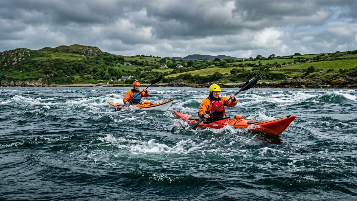
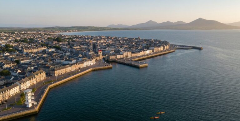
Kayaking in Strangford Lough is an experience dictated by the moon. As the largest inlet in Ireland, this massive body of water in County Down is famous for its extreme tidal variations. For kayakers, it offers two completely different worlds: tranquil island-hopping on the western shores, and adrenaline-pumping tidal races through The Narrows.
Why Kayak in Strangford Lough?
Strangford Lough is a designated Marine Nature Reserve, a Special Area of Conservation, and an Area of Outstanding Natural Beauty. The sheer volume of water that rushes in and out of the Irish Sea twice a day creates a highly nutrient-rich environment, making it a haven for marine wildlife.
Paddlers frequently encounter common and grey seals, porpoises, and thousands of wintering Brent Geese. Beyond the wildlife, the lough is dotted with over seventy islands and historic ruins, including ancient monasteries and tower houses that are best viewed from the waterline.
Who Should Paddle Here?
The stark contrast between the inner lough and the entrance means that Strangford caters to every level of paddler, provided you know exactly where to launch.
For the Beginners
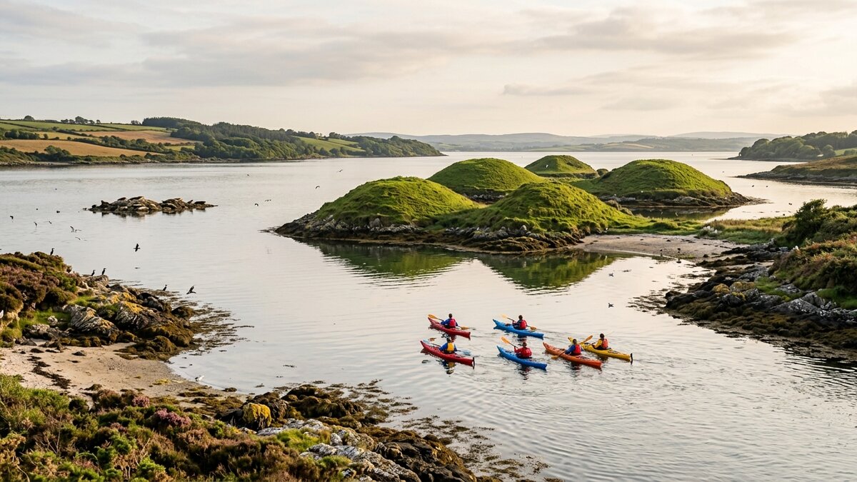
Beginners and families should stick to the western shoreline, particularly around Whiterock, Killyleagh, and the Quoile River barrier. This area is affectionately known as the “basket of eggs” due to the sunken drumlin islands that break up the wind and provide highly sheltered, flatwater conditions.
For the Experts
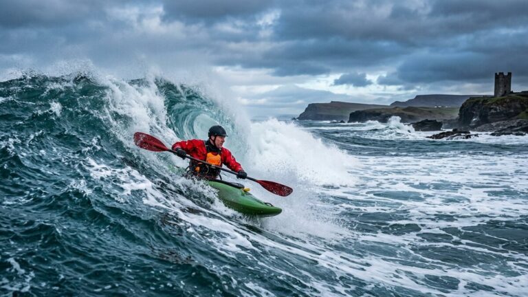
The Narrows—the five-mile channel connecting the lough to the Irish Sea between Portaferry and Strangford village—is strictly for advanced sea kayakers with genuine tidal expertise, not an intermediate outing even around slack water. The water here moves at up to eight knots during spring tides. It creates standing waves, intense eddylines, and whirlpools, most notably the infamous “Routen Wheel,” which the Strangford & Lecale AONB Partnership and the National Trust both say should be treated with extreme caution, especially when wind opposes tide. The Portaferry–Strangford vehicle ferry also crosses the channel roughly every 30 minutes, so you need to watch for ferry and other boat traffic on top of the current itself. You must have robust rough-water skills, a bombproof roll, a full tide-and-wind plan worked out in advance, and a clear escape route back to shore if conditions turn — most paddlers are better off tackling this stretch with a local guide who knows the Narrows’ timing.
Understanding the Tides
You cannot kayak in Strangford Lough without consulting a tide table — see the Strangford & Lecale AONB Partnership’s on-water safety guidance before you go.
When the tide is ebbing (going out), around 350 million cubic metres of seawater surge through The Narrows on every tide, according to the Strangford & Lecale AONB Partnership. This creates powerful outward currents in The Narrows. In the shallower northern and eastern reaches of the lough, an outgoing tide can leave you stranded on vast, impassable mudflats for hours.
| Condition | Inner Lough (Whiterock) | The Narrows (Portaferry) | Required Skill Level |
|---|---|---|---|
| Slack Water | Calm, ideal for touring | Brief window of calm | Beginner (Inner) / Advanced (Narrows) |
| Mid-Tide (Neaps) | Gentle flow, easy paddling | Fast currents, small whirlpools | Beginner (Inner) / Advanced (Narrows) |
| Mid-Tide (Springs) | Noticeable flow around islands | Extreme currents, standing waves | Intermediate (Inner) / Expert (Narrows) |
Top Launch Spots and Routes
The Strangford Lough Canoe Trail, maintained by Outdoor Recreation NI, provides excellent infrastructure for paddlers, with marked access points and even dedicated camping spots — check the official interactive map for current access guidance before you launch.
Whiterock and Ballydorn
Located on the western shore, the launch points around Whiterock and Ballydorn (roughly 54.49, -5.65, near the public slipway by Down Cruising Club — treat this as an approximate position and confirm locally) are the gateway to the “basket of eggs.” You can easily spend a full day weaving between Sketrick Island, Mahee Island (home to Nendrum Monastic Site), and Trasnagh Island. The waters here are generally sheltered from the prevailing south-westerly winds, though conditions can still change, so check the tide and forecast before you launch.
Salt Island (For Camping)
If you are planning an overnight trip, Salt Island is a crown jewel. Managed by the National Trust, the island features a dedicated bothy (a basic stone shelter) and camping area specifically for canoeists and kayakers, roughly 54.376, -5.644 off the Killyleagh side (an approximate position — confirm your crossing point locally). The bothy is kept locked when not in use, so you must book in advance through the National Trust before you go, and bring your own drinking water, cooking gear, and firewood. The Trust also asks paddlers not to land on islands being used by seals for haul-outs, by breeding seabirds, or where cattle are grazing — treat this as standard practice at Salt Island too.
The Quoile River (Jane’s Shore)
For those who want calmer water, launching from Jane’s Shore on the Quoile River is a good option. The river is cut off from the main tidal lough by the Quoile Barrage, which makes it relatively sheltered compared with the open lough — though weather and water conditions can still change, so it’s not a guaranteed flatwater or wind-free paddle. It can suit beginners, children, or paddlers looking for a more relaxed evening paddle, provided they have suitable supervision and check conditions first. There’s a small lay-by for parking on the road (roughly 54.3455, -5.7115 — approximate, confirm locally), then a path through a fence down to the river.
How to Prepare and What to Bring
Because Strangford Lough is a tidal sea environment, your safety gear must reflect the conditions.
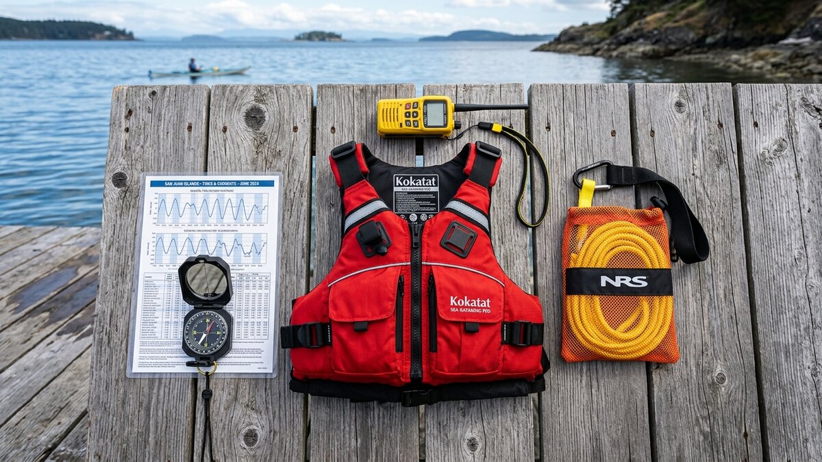
For any trip beyond the Quoile River barrier, you must carry a laminated tide table and a waterproof watch. A marine VHF radio is highly recommended for calling the Coastguard in an emergency — Belfast Coastguard covers this area (dial 999 and ask for Coastguard, or call on VHF Channel 16). A high-visibility touring PFD, a spray deck, and a tow line are standard requirements for sea kayaking in this region.
Local Tour Operators and Guides
If you are unfamiliar with tidal planning, hiring a local guide is the smartest decision you can make.
Operators like the Strangford Lough Activity Centre (SLAC) and Mobile Team Adventure run superb guided trips. They offer everything from beginner-friendly sunset paddles around the islands to high-adrenaline tidal rapid sessions in The Narrows for experienced groups. A guided tour removes the stress of calculating tide times and ensures you see the best wildlife spots without disturbing sensitive habitats.
Common Mistakes to Avoid
Strangford Lough requires respect. Avoid these frequent errors made by visiting paddlers.
Ignoring the Mudflats
The northern end of the lough (around Newtownards) and the eastern shores become massive expanses of deep, sticky mud at low tide. If you miscalculate your return journey on an ebbing tide, you will find yourself stuck hundreds of metres from the shoreline, unable to drag your kayak through the mud.
Disturbing the Wildlife
The lough is a sanctuary for breeding birds and seals. During pupping season, seals will haul out onto the lower rocks. Never paddle directly at a seal haul-out, and do not land on islands used by seals, breeding seabirds, or grazing cattle, or marked with National Trust restriction signs during bird breeding season (typically spring and early summer) — see the National Trust’s Strangford Lough kayaking guidance for details.
What Can Go Wrong (Risks)
The greatest risk in Strangford Lough is the tidal flow in The Narrows.
If you venture too close to the Routen Wheel or get caught in the main channel during a spring ebb tide, the water moves faster than you can paddle. You can be swept out into the open Irish Sea or capsized by the turbulent eddylines. If you do not have the skills to self-rescue in rough water, you must stay away from the southern end of the lough.
Costs and Budgeting
Access to the water is generally free via public slipways, but guided tours and rentals offer excellent value for the safety they provide.
At the Strangford Lough Activity Centre, single kayak hire starts from £28 for 3 hours (a 6-hour option is also available), and their guided Coastal Tour sea-kayak trip (Burr Point to Cloughey/Kearney) runs £49 per person using their kit, or £35 per person if you bring your own kayak, for a 3-hour trip. Mobile Team Adventure runs Monday-evening sea kayaking sessions from Whiterock between April and September, priced at £40 per person for a single 2-hour evening, dropping to £30–35 per person per night if you book three or more evenings. Both operators also run bespoke trips — such as SLAC’s Sea Kayaking Skills Course and Mobile Team’s private Island Explorer experience — that are quoted on request rather than listed at a fixed price, so contact them directly for the current rate. Prices above were checked 8 September 2026 and can change, so confirm the current rate on the operator’s own booking page before you go.
5 Frequently Asked Questions
1. Do I need a permit to kayak in Strangford Lough?
No, you do not need a permit to paddle the public waters. However, landing on certain islands is restricted by the National Trust to protect breeding wildlife.
2. Can I cross the Strangford Narrows in a kayak?
Only with serious tidal experience — it isn’t a simple yes. The Narrows demands advanced sea-kayaking skills, a full tide-and-wind plan, and a clear escape route, even around slack water (the brief period when the tide is turning and the water stops moving). Conditions can still be complicated by wind against tide, the Routen Wheel, and the Portaferry–Strangford vehicle ferry crossing the channel. Attempting to cross outside slack water, or without this level of planning, is highly dangerous, and most paddlers should only attempt it with a local guide.
3. Are there changing facilities at the launch spots?
Facilities vary. The public slipways at Whiterock and Killyleagh have nearby public toilets, but no dedicated changing rooms. Paddlers typically use a changing robe at their cars.
4. What is the Strangford Lough Canoe Trail?
It is a mapped trail covering the entire lough, detailing official launch points, camping spots (like Salt Island), and points of historical interest. You can view the official interactive map via Outdoor Recreation NI / OutmoreNI, which has now replaced the old CanoeNI site.
5. Can I see seals from a kayak?
Yes, Strangford Lough is home to large colonies of both common and grey seals. They are very curious and will often pop their heads up near your kayak. Always maintain a respectful distance and do not chase them.

No comments yet on this guide.
Be the first to share your experience — conditions, access, hazards, or anything a future paddler should know.
Login to join the discussion