Kayaking Wicklow gives you five completely different types of paddling across one coastal county — open sea-kayaking along dramatic headlands from Bray to Wicklow Head, sheltered harbour paddling inside Wicklow Town, Grade 2 river kayaking on the Avonmore through the Vale of Avoca, and two mountain water destinations — Glendalough and Lough Tay — that draw thousands of Google searches a year but require honest answers about what is and is not actually paddleable. No other county in Ireland packs this range of paddling environments into a 50-kilometre stretch of coastline and mountains.
This guide covers every realistic kayaking option in County Wicklow in 2026, with accurate access rules, verified operator prices, the safety factors the booking sites do not mention (tides off Wicklow Head, acid mine drainage on the lower Avoca, cold mountain water at Lough Tay), the cultural and historical context that makes this county worth knowing beyond the paddle itself, and the two specific Wicklow questions that consistently appear in online searches but rarely get a straight answer: can you kayak on Glendalough’s lakes, and can you kayak on Lough Tay?
Five Zones, One County
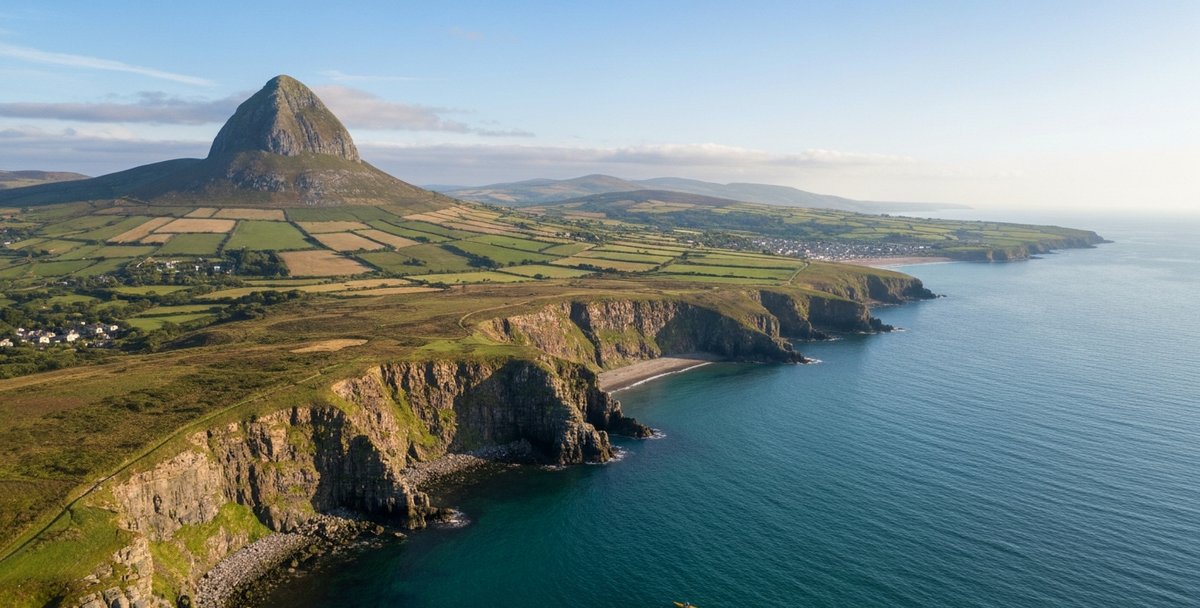
Wicklow’s paddling geography divides into five distinct zones. Understanding which zone you are heading to — and crucially what the access rules are — is the single most important piece of planning you will do before putting a kayak on a car roof and driving to the Garden County.
Zone A — Greystones and Bray Head: Sea kayaking along the granite coastal cliffs south of Dublin. Sheltered launch at Greystones Harbour, tidal headland route along Bray Head. Suits intermediate sea kayakers and beginners on guided tours.
Zone B — Glendalough (Upper and Lower Lakes): NPWS has designated Glendalough as a National Nature Reserve. All kayaking, canoeing, and boating are explicitly prohibited on both lakes. No permit scheme exists. This applies to both commercial and private paddlers. Read the full section before you plan a trip here.
Zone C — Lough Tay (Guinness Lake): Entirely private property, sold to new private owners in 2019. Paddling is not legally permitted without explicit written permission from the estate. The iconic view from the R759 road is a viewpoint, not a launch point. Read the full section for the access reality and the formal contact route.
Zone D — Wicklow Town and Wicklow Head: The main commercial paddling base in the county. Sheltered flat-water paddling on The Murrough lagoon, tidal coastal route to Wicklow Head, kayak hire on the Vartry River and Broad Lough — confirm whether guided tours are currently running before booking. The correct choice for most visitors wanting a sea-kayak experience in Wicklow.
Zone E — Avoca River and Vale of Avoca: River paddling from Rathdrum downstream through the Meeting of the Waters to Arklow. Grade 2 with Grade 2+ sections, the most technically demanding freshwater paddling in the county. The lower stretches below the Meeting of the Waters carry acid mine drainage from the Avoca copper mines — the water is heavily discoloured and ecologically damaged, and EPA monitoring has historically rated this stretch among the most polluted river water in Ireland.
Zone A — Greystones and Bray Head Sea Kayaking
The coastline between Bray and Greystones is Wicklow’s busiest sea-kayak stretch, close enough to Dublin to attract day-trippers but with genuine sea-cliff character that rewards experienced paddlers as much as beginners on tours. The two towns sit at either end of a 6-kilometre stretch of rocky foreshore backed by the granite bulk of Bray Head, and the launch logistics at each end are very different.
Greystones Harbour
Greystones Harbour is the more sheltered and practical launch point at the southern end of the Bray-to-Greystones coastal stretch. The harbour is a working marina on the north side of Greystones town, with a slipway accessible at most states of the tide. There is paid car parking at the harbour (check current charges on arrival). Greystones is reached from Dublin by DART — the station is a five-minute walk from the slipway — making it one of the few Irish sea-kayak launch points with viable public transport access.
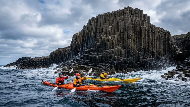
From Greystones, the typical guided tour route heads north along the cliffs toward Bray Head, with rocky sea stacks, caves, and, in season, seabird colonies along the cliff base. The crossing of Bray Head requires navigating around the headland’s southern tip — an exposed section where swell can wrap around the point and where the wind tends to accelerate along the cliff face. Guided operators manage this section based on the day’s conditions; self-launching intermediates should check the Greystones Harbour weather forecasts and leave a float plan.
Bray Head
Bray Head is the rocky promontory rising steeply above the southern end of Bray’s promenade. From the water, it is a different and far more dramatic place than it appears from the DART train that runs along its base. The cliff face drops almost vertically to the sea along its southern aspect, and the wave-cut platform at low tide reveals caves, arches, and a series of small natural rock harbours visible only to paddlers.
Conditions off Bray Head are more exposed than conditions in Greystones Harbour. Swell from the south-east funnels into the headland and can generate confused chop around the tidal races at the southern tip. There is no dedicated slipway at the Bray Head end — kayakers launching from Bray promenade beach face a shingle entry that is uncomfortable in any significant onshore wind. The practical guidance for most paddlers is to base yourself at Greystones and treat Bray Head as a destination rather than a launch point.
Multiple commercial operators run guided sea-kayak trips along this stretch. Contact Wicklow Kayaking (wicklowkayaking.ie) or check the Canoeing Ireland operator directory for current Bray and Greystones providers, as operator rosters change between seasons. Bray Tourism also maintains a current activities listing at bray.ie.
What to expect on the water
The Greystones-to-Bray coastal stretch is predominantly sheltered by the headland from westerly winds — Wicklow’s prevailing direction — but is directly exposed to south-easterly wind and swell from the Irish Sea. In calm summer conditions the water inside the cliffs is mill-pond flat. In an easterly blow of even 15 to 20 knots, conditions deteriorate quickly and the cliff coastline offers few bail-out options for a paddler in difficulty. The Irish Sea water temperature off the Wicklow coast runs from 8°C in February and March up to 15°C in August and September, with occasional peaks around 17°C in the best of summer. A wetsuit is minimum exposure protection from April to October; a drysuit is appropriate from October to April.
Zone B — Glendalough: Why You Cannot Kayak Here
Glendalough is one of the most photographed landscapes in Ireland — a deep glacial valley in the Wicklow Mountains containing two lakes (the Lower Lake and the Upper Lake), the round tower and cathedral ruins of St Kevin’s 6th-century monastic city, and a mountain backdrop that turns orange and gold in autumn. It also generates a significant number of Google searches every year from people wondering whether they can paddle on those lakes.
The answer is no, and the prohibition is explicit.
The NPWS designation
Glendalough is designated as a National Nature Reserve under Irish wildlife legislation, managed by the National Parks and Wildlife Service (NPWS). The designation protects both the freshwater ecology and the monastic archaeology of the valley. Under this designation, boats, canoes, kayaks and paddleboards are forbidden on both the Lower Lake and the Upper Lake except under permit — and in practice, no permit scheme is open to recreational or commercial paddlers. The NPWS Wicklow visitor FAQ is explicit: no boating, canoeing or kayaking is permitted on either lake. This applies to private individuals, clubs, guided tour operators, and everyone else.
This is not a grey-area situation or an old rule nobody enforces — it is stated plainly in the park’s own public guidance, not just buried in the underlying legislation.
What St Kevin built and what you can see from the shore
St Kevin founded the monastic settlement at Glendalough in the late 6th century. He died around 618 AD. The monks who came after him built one of the most complete surviving collections of early Christian stone architecture in Ireland — the 30-metre round tower still stands to its full height, the cathedral ruins cover the largest floor area of any pre-Norman Irish church, and St Kevin’s Kitchen (a barrel-vaulted oratory with its own small round tower) sits intact on the Lower Lake shore.
From the Lower Lake shoreline footpath, directly opposite the main monastic complex, you can see the round tower, the cathedral ruins, and St Kevin’s Kitchen across roughly 150 metres of water. The reflection in calm morning light is genuinely extraordinary. The Upper Lake — a wilder, darker stretch of water hemmed in by steep scree and old-growth oak woodland — cannot be seen from the main monastic precinct; it requires a 2-kilometre walk up the valley from the car park, past the Lower Lake, to reach the boardwalk and shore at the far end.
The point for paddlers planning a Wicklow trip is this: Glendalough is absolutely worth visiting, and the two lakes are beautiful. You simply cannot paddle on them. If you want mountain-lake kayaking in Wicklow, the county’s option for that is the club-based Vartry Reservoir near Roundwood, where a local kayak club operates and holds club paddle sessions open to new members — confirm its current name and contact route before publishing, as wicklowkayakclub.ie does not currently resolve to a live site. It is quieter, less famous, and entirely paddleable.
Vikings, raids, and the 1798 rebellion connection
Glendalough’s valley was raided by Vikings from around 837 AD onward — the narrow valley entrance and its accumulated wealth of metalwork and illuminated manuscripts made it a repeated target. The monastery was burned multiple times between the 9th and 12th centuries, rebuilt after each raid, and eventually declined following Anglo-Norman consolidation of the region in the late 12th century. By the time the Wicklow Mountains became a refuge for the United Irishmen rebels in 1798, Glendalough was already a ruin visited by travellers on the Grand Tour route.
The 1798 rebellion’s Wicklow dimension was fought and fled through the same valleys that hold these lakes. Michael Dwyer, a Wicklow man from Imaal, conducted a five-year guerrilla campaign in the Wicklow Mountains after the rebellion’s collapse — using the same trackless upland that makes the region spectacular for hikers and kayak clubs today. The Battle of Arklow on 9 June 1798 was the decisive coastal engagement, stopping the United Irishmen’s march north toward Dublin at the mouth of the Avoca River.
Zone C — Lough Tay: The Guinness Lake and the Private Estate Reality
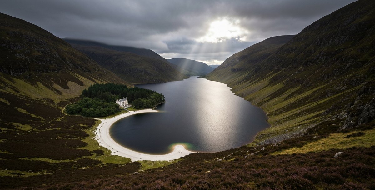
Lough Tay sits in a steep glacial corrie on the Luggala estate, visible from a layby on the R759 road about 10 kilometres south of Roundwood. It is the most photographed inland water in County Wicklow, possibly in all of Ireland. The reason is that from the road above, the lake looks exactly like a glass of Guinness: the black peat-stained water contrasts sharply with the white sand beach at the north end, the whole composition held in a bowl of dark mountain grass and heather. The image circulates widely on social media and generates consistent search volume for “kayaking Lough Tay.”
The answer is more complicated than Glendalough’s flat prohibition, but the practical outcome for almost everyone is the same: you cannot paddle here without the estate’s explicit permission.
Ownership history
Luggala Lodge and the surrounding estate were built around 1787 by the La Touche banking family as a Gothic Revival hunting lodge. Ernest Guinness acquired the property in 1937 as a wedding gift for his daughter Oonagh Guinness. The estate became famous through the 20th century as the home of Oonagh’s son Garech de Brún — a Guinness heir, co-founder of Claddagh Records, and patron of Irish traditional music who hosted musicians, writers, and cultural figures at Luggala for decades. Garech de Brún died in 2018.
In 2019, Luggala Estate was sold to new private owners. The estate has remained private property since. The lodge is occasionally available for exclusive private hire — it can be rented in its entirety for weddings, retreats, and corporate events — but the estate itself remains private.
The access reality for paddlers
Lough Tay is private property in its entirety. The lakeshore, the beach, the approach paths, and the water itself are part of the Luggala Estate and do not fall within any NPWS jurisdiction — the lake is adjacent to Wicklow Mountains National Park land but is not within the park boundary, so NPWS has no management role here and no permits to issue. There is no public right of way from the R759 road to the lakeshore; the viewpoint layby on the road is the only legitimate public vantage point.
No commercial kayak operators run trips on Lough Tay.
The lake has a maximum depth of 35 metres, sits at approximately 280 metres above sea level, and fills a narrow glacial valley that acts as a wind funnel. The water is cold year-round — significantly colder than the Irish Sea coast — with no monitoring of water quality or paddling safety on-site.
If you want to attempt formal access
The only realistic route to kayaking Lough Tay is a written request to Luggala Estate directly. Frame it as a private arrangement, acknowledge the lake’s private status, and be prepared for a refusal or no response. Contact the estate through the Luggala Estate access page or by email at info@luggala.com. Do not arrive at the R759 viewpoint with a kayak on your car roof expecting to carry it down — the land between the road and the water is private and there is no path.
Zone D — Wicklow Town and Wicklow Head
Wicklow Town is where most people who search for kayaking in County Wicklow will actually end up paddling, and for good reason. It has a functioning commercial operator, two distinct environments (a flat sheltered lagoon and a tidal coastal route), a town with food and parking, and the cultural depth of one of the oldest continuously inhabited harbour towns in Ireland.
Wicklow Town: Viking origin and Norman castle
Wicklow Town takes its name directly from the Old Norse “Wykinglo” — meaning Viking harbour or Viking meadow — established by Norse settlers in the mid-9th century, a couple of decades after the same Vikings first began raiding Glendalough. The town remained a Norse trading post for two centuries before the Anglo-Normans arrived and built Wicklow Castle, the ruins of which still stand above the harbour. The Black Castle ruin on its sea-cliff promontory north of the harbour is a direct product of the 1169 Norman settlement.
The harbour has been the town’s economic engine since Norse times. Today it handles fishing vessels, leisure boats, and a small amount of coastal cargo. The harbour mouth faces due east, toward the Welsh coast, and the tidal streams in the outer approaches are affected by Horseshoe Bank — a shoal just south of Wicklow Head that creates overfalls and locally strong tidal streams in certain wind-against-tide combinations. Wicklow Head Lighthouse stands on the headland south of town. The first lighthouses here were built in 1781, but they proved unreliable in fog and were replaced by new, lower towers in 1818 — it is that 1818 light (automated in 1994) which is still operational today. The original 1781 rear tower still stands nearby as a landmark and is now let as holiday accommodation, rather than functioning as the working light. Even so, Wicklow Head has been marked by a lighthouse for close to 245 years, though the current tower is not the oldest operational lighthouse in Ireland — that distinction belongs to Hook Head in County Wexford, built in the early 13th century.
The Murrough — flat-water kayaking
The Murrough is a narrow lagoon running parallel to the sea for several kilometres along the coast north of Wicklow Town, separated from the Irish Sea by a shingle ridge. It is the flattest, most sheltered paddling water in County Wicklow. The lagoon holds a mixture of reed bed, open water, and wetland habitat — it is part of the Murrough Wetlands SAC and the Murrough SPA bird protection zone — and it paddles very differently from the open-coast sea kayaking at Greystones.
Wicklow Kayaking (wicklowkayaking.ie) hires kayaks from the Vartry River and Broad Lough in Wicklow Town, not from the Murrough itself — minimum age 8, and Broad Lough is tidal, so call the operator directly for current tide advice (checked September 2026). The Murrough itself remains the flattest, most sheltered stretch of water in this zone for paddlers bringing their own boat.
Coastal route to Wicklow Head
The route south from Wicklow Harbour toward Wicklow Head is the tidal sea-kayak route in this zone. Wicklow Head is exposed: Horseshoe Bank and associated shoals generate confused water and accelerated tidal streams in all but the calmest conditions, and the MRCC Dublin search-and-rescue zone boundary runs through this area. Wicklow RNLI has been called out to kayak incidents in the harbour mouth and immediately offshore on multiple occasions in recent years; the combination of spring tides, offshore winds, and paddlers underestimating the conditions around the headland is the consistent pattern. Wicklow Head Coast Guard Radio monitors VHF Channel 16 continuously, operates on Channels 02 and 67, and uses DSC on Channel 70 — Channel 16 and 112 are for emergency use, not a pre-trip check-in. Leave a float plan ashore instead, and only round the headland in settled conditions.
Summary for Zone D:
| Paddling environment | Difficulty | Operator |
|---|---|---|
| The Murrough (lagoon) | Beginner | Self-launch |
| Vartry River / Broad Lough | Beginner | Wicklow Kayaking (hire, age 8+) |
| Wicklow Harbour (sheltered) | Beginner–Intermediate | Self-launch |
| Wicklow Head coastal route | Intermediate–Advanced | Confirm with operator |
Zone E — The Avoca River and the Vale of Avoca
The Avoca River is the only Grade 2 river kayaking in Wicklow that is accessible to non-club paddlers with a reasonable skill base, and it carries one of the most loaded pieces of Irish cultural geography that any paddling route touches. The confluence of the Avonmore and Avonbeg rivers at the Meeting of the Waters, in the Vale of Avoca, is where Thomas Moore sat in the summer of 1807 and was moved to write the most famous nature poem in the Irish canon.
Thomas Moore and the Meeting of the Waters
Thomas Moore visited the Vale of Avoca in the summer of 1807 and published “The Meeting of the Waters” in the first volume of his Irish Melodies in April 1808. The poem’s opening — There is not in the wide world a valley so sweet / As that vale in whose bosom the bright waters meet — refers specifically to the confluence of the Avonmore and Avonbeg rivers at Avoca village. Moore sat under an ash tree on the riverbank, now marked with a plaque, and wrote about the peace of this particular place at this particular moment of Irish history, before Catholic Emancipation and the political storms that would follow. The poem became one of the best-known songs in the Victorian-era drawing rooms of Ireland, Britain, and the Irish diaspora worldwide.
It is a different Meeting of the Waters from the one in Killarney — the Kerry phrase refers to the junction of the three Killarney lakes at Old Weir Bridge. Wicklow’s is a river confluence. If you are paddling from Rathdrum downstream on the Avonmore, you will reach it approximately 7.5 kilometres into the run.
The paddling route
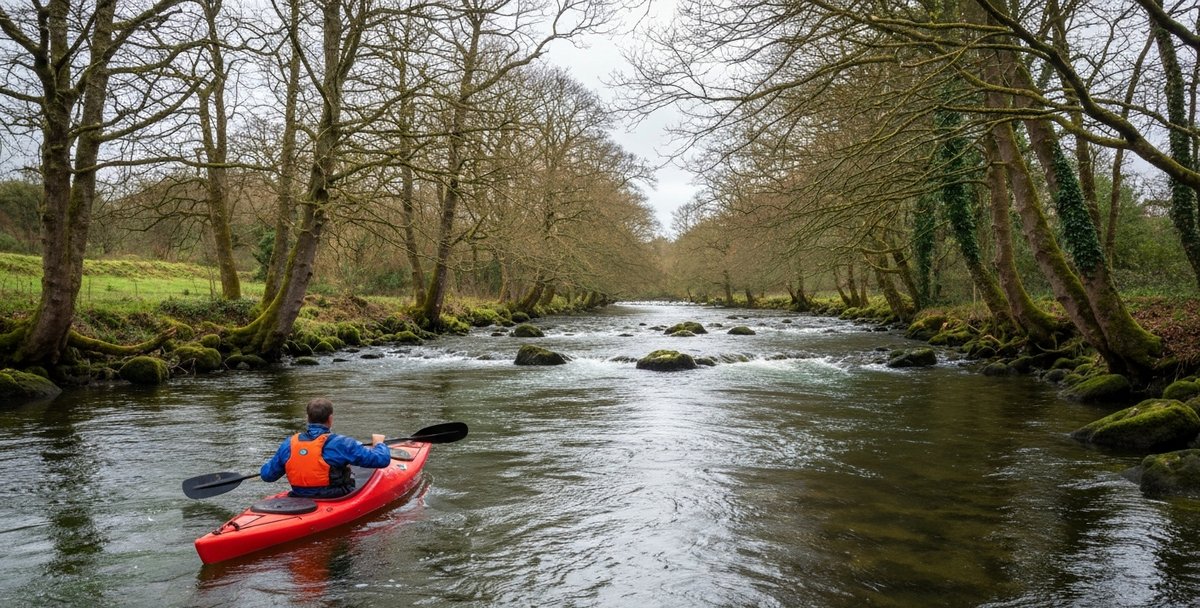
The standard run on the Avoca system starts from Rathdrum Bridge and follows the Avonmore River downstream to the Meeting of the Waters at Avoca village — approximately 7.5 kilometres at Grade 2 difficulty, with multiple waves and small rapids, as logged in the Irish Whitewater river guide. The river runs best at medium to high water levels; in low summer conditions it becomes shallow and scrappy in sections. The gradient is moderate throughout, with no serious Grade 3 features on this section under normal flows.
From the Meeting of the Waters, the river continues as the Avoca south toward Arklow, roughly 8 to 10 kilometres of slower, gentler paddling to the sea. This lower section is where the issue of mine drainage becomes relevant.
The Avoca copper mines and the acid river
The Avoca copper mines are among the oldest worked mines in Ireland, with extraction evidence dating to the Bronze Age and systematic industrial mining continuing through the 18th and 19th centuries. The mines closed in 1982. The legacy they left in the river system is chemically significant and visually unmistakable.
Acid mine drainage from the oxidising sulphide mineral waste — particularly pyrite and chalcopyrite — produces sulphuric acid which dissolves iron and heavy metals into the surrounding groundwater. This drains into the lower Avoca and colours the river a distinctive orange-ochre-brown downstream of the mine complex. The water in the lower Avoca below the mine drainage points contains elevated levels of copper, iron, zinc, and aluminium. The ecological damage is severe — the lower river supports near-zero fish populations and minimal invertebrate life in the worst-affected stretches.
For paddlers, the practical guidance is straightforward: the upper Avonmore section (Rathdrum to Meeting of the Waters) is not affected by mine drainage and paddles as normal. The lower Avoca below the mine confluence carries visibly discoloured water contaminated with heavy metals from acid mine drainage — EPA-linked monitoring has rated this stretch among the most polluted river water in Ireland. WaterEgo is not in a position to declare this water safe for skin contact; check current EPA or local water quality guidance and ask a local club before paddling here. The visual discolouration is self-evident — if the water looks orange, you are in the mine-drainage zone.
Arklow and the sea
The Avoca River mouth at Arklow is where the river meets the sea, and the estuary carries the mine drainage with it. An Arklow-based kayak club can advise on current conditions on both the estuary and the offshore Arklow Bank stretch of coast, though its exact current name and contact details should be reconfirmed before publishing (see notes). The town itself has a working harbour and a direct rail connection to Dublin Connolly on the Rosslare Europort line.
Season, Conditions and the Wicklow Paddle Planner
| Month | Sea Temp | Typical exposure protection* | Murrough Lagoon | Bray / Greystones Sea | Wicklow Head Coast | Avoca River (Grade 2) |
|---|---|---|---|---|---|---|
| Jan | 10°C | Drysuit | Shoulder | Off-season | Off-season | Peak |
| Feb | 8°C | Drysuit | Shoulder | Off-season | Off-season | Peak |
| Mar | 8°C | Drysuit | Shoulder | Marginal | Off-season | Peak |
| Apr | 9°C | Drysuit | Peak | Shoulder | Marginal | Peak |
| May | 11°C | 5mm wetsuit | Peak | Peak | Shoulder | Marginal (low flow) |
| Jun | 13°C | 5mm wetsuit | Peak | Peak | Peak | Off-season (dry) |
| Jul | 15°C | 3mm wetsuit | Peak | Peak | Peak | Off-season (dry) |
| Aug | 15°C | 3mm wetsuit | Peak | Peak | Peak | Off-season (dry) |
| Sep | 14°C | 5mm wetsuit | Peak | Shoulder | Shoulder | Marginal |
| Oct | 11°C | Drysuit | Peak | Marginal | Off-season | Peak |
| Nov | 10°C | Drysuit | Shoulder | Off-season | Off-season | Peak |
| Dec | 9°C | Drysuit | Shoulder | Off-season | Off-season | Peak |
*Starting point based on sea temperature only — actual choice depends on your own cold tolerance, immersion risk and trip length. These are typical seasonal patterns, not a forecast for any given day: always check the actual wind, swell, tide and river-level conditions, your group’s skill and equipment, and go out with a rescue plan and a competent group.
River level guide: check EPA HydroNet Rathdrum gauge — best at 0.5–0.8m; below 0.4m too rocky.
Wicklow’s paddling season has a clear structure shaped by sea temperature, river levels, and the prevailing south-westerly wind.
Sea temperature off Wicklow: 8°C February–March (drysuit essential), 10–11°C April–May (drysuit strongly recommended), 12–13°C June, 14–15°C July–August (wetsuit minimum), 13°C September, 11°C October, back toward 8°C by December. Cold water shock — the involuntary gasp reflex on sudden immersion — occurs immediately at temperatures below 15°C. In water this cold, the RNLI’s guidance is that the initial gasp response passes within about a minute, but useful, coordinated arm and leg movement is lost within roughly 10 minutes as the muscles stop responding to cold. A drysuit is strongly recommended from October to April for sea paddling in Wicklow — the right choice on the day still depends on your own cold tolerance, immersion risk and how far you are from help.
Best months by zone:
| Zone | Best months | Notes |
|---|---|---|
| Greystones / Bray Head | May–September | Check the day’s easterly wind and swell forecast before heading out |
| Wicklow Town / Murrough | April–October | Sheltered lagoon year-round; kayak hire nearby on Broad Lough |
| Wicklow Head route | June–August only | Spring tides + easterly = avoid |
| Avoca river (Rathdrum–MoW) | November–April | Requires good flow; summer often too low |
| Avoca lower / Arklow | November–April | Same; plus avoid after heavy rainfall |
River level guidance: The Avonmore runs best between 0.5m and 0.8m on the Rathdrum gauge. Below 0.4m the rocks are too exposed for a comfortable descent. Check EPA River Watch (epa.ie/hydronet) or Flo-2D for current gauge readings before driving to Rathdrum.
Tides off Wicklow: Wicklow has a semi-diurnal tidal pattern (two high waters and two low waters per day). Mean spring range at Wicklow Harbour: approximately 3.1 metres. Neap range: approximately 2.0 metres. The worst hazard window is spring ebb combined with a south-easterly wind — this creates wind-against-tide conditions off the headland with short, steep sea. Check UKHO Admiralty tidal data or the Tidepod app for Wicklow Harbour tide times.
Prevailing wind: South-west to west. This means the coastline from Greystones to Wicklow Head is largely sheltered in the prevailing direction — the mountains and hills of inland Wicklow provide a natural windbreak from westerly weather. Easterly winds are the opposite: they blow directly onshore and build sea chop against any paddler heading south along the coast. Treat any forecast of strengthening easterly or south-easterly wind as a reason to reassess the plan for anything outside sheltered harbour or lagoon environments — the actual cut-off depends on swell, fetch, your group’s skill level and the bail-out options on that stretch, not wind speed alone.
Operators and Clubs in County Wicklow
| Zone | Type | Difficulty | Access | Operator / Club | Best Season |
|---|---|---|---|---|---|
| A — Greystones / Bray Head | Sea kayaking | Intermediate | Public · guided available | Wicklow Kayaking (verify other operators before booking) | May–September |
| B — Glendalough Lakes | Lakes (Upper + Lower) | N/A | PROHIBITED — NPWS | None — no permit exists | All year — banned |
| C — Lough Tay (Guinness Lake) | Mountain lake | N/A | Private estate only | Self-contact estate (luggala.com); written request required | No public season |
| D — Wicklow Town / Murrough | Sea + lagoon (sheltered) | Beginner–Intermediate | Public · hire available | Wicklow Kayaking (wicklowkayaking.ie, Vartry River/Broad Lough) · Irish Rail accessible | April–October; lagoon year-round |
| E — Avoca River / Arklow | River — Grade 2/2+ | Intermediate | Public · self-launch | Local kayak club — verify current contact | November–April (needs flow) |
Commercial operators
Wicklow Kayaking (wicklowkayaking.ie) — Kayak hire on the Vartry River and Broad Lough, Wicklow Town, minimum age 8. Broad Lough is tidal — call the operator directly for current tide advice. Confirm whether guided sea tours or courses are currently offered before booking; the operator’s own site (checked September 2026) describes hire only. Contact via the website for current 2026 pricing and availability. Wicklow station is served by Irish Rail’s Dublin–Rosslare service — the DART network itself terminates further north at Greystones.
Portobello Adventure — a Dublin-based operator that ran guided coastal kayak trips along the north Wicklow coast (Killiney to Bray Head zone, depending on conditions) as of 2025. Its website (portobelloadventure.ie) is no longer online as of 2026 and the domain is currently unregistered, so confirm the operator is still trading under this or another name before referring readers to it.
For the broader national operator directory, see the Kayak Rental Ireland guide which covers 54 verified operators by county.
Clubs
Wicklow Kayak Club — Based at Vartry Reservoir near Roundwood, running club paddle days, development sessions, and beginner courses; confirm its current name and web presence before publishing, as wicklowkayakclub.ie does not currently resolve to a live site. The reservoir is the practical mountain-water paddling alternative to the prohibited Glendalough lakes and private Lough Tay. Annual membership gives access to club paddles, coaching, and equipment loan programmes.
Arklow Kayak Club — Based at Arklow Harbour and the Avoca estuary, running river and coastal sessions; confirm its current name, contact details and web presence before publishing, as arklowkayakclub.ie does not currently resolve to a live site.
For the full national club directory covering all 45 verified clubs across every county, see the Kayaking Clubs in Ireland guide.
Safety in Wicklow Waters
Legal requirement: buoyancy aid
Under Irish law, all paddlers are required to wear a CE/ISO-certified buoyancy aid of at least 50 Newtons at all times while engaged in paddle sports. This applies equally on sheltered inland water, tidal harbours, and open-sea environments. A buoyancy aid is not the same as a lifejacket — a buoyancy aid requires the wearer to be conscious and able to keep themselves face-up; it will not self-right an unconscious casualty. Choose one rated for the discipline and conditions you’re paddling in, and get advice from a club or retailer if you’re not sure which.
Cold water
As noted in the season section, the Irish Sea off Wicklow is cold year-round. Cold water shock causes an involuntary gasp reflex on immersion that can pull water into the lungs before you surface from a capsize. The reflex is involuntary — it cannot be trained away without cold-water acclimatisation practice. Wearing a wetsuit or drysuit significantly reduces (but does not eliminate) the cold shock response. The practical minimum for coastal Wicklow paddling from October to April is a 5mm wetsuit with boots and gloves; a drysuit is better.
Coast guard and emergency contacts
Coastguard emergency: VHF Channel 16 (monitored continuously along the Wicklow coast) or 999 / 112.
Wicklow Head Coast Guard Radio: Channels 16, 02, 67. DSC on Channel 70.
MRCC Dublin: The Maritime Rescue Co-ordination Centre for the Dublin region covers the full Wicklow coastline. They co-ordinate Wicklow RNLI and Coast Guard helicopter response.
Wicklow RNLI: Based at Wicklow Harbour. Responds to coastal kayak incidents. Wicklow RNLI records multiple call-outs to kayakers annually — most involve spring tides and offshore wind off Wicklow Head, which push paddlers out to sea faster than they can paddle back.
Leave a float plan: Before any sea-kayak session on the Wicklow coast, tell someone on shore where you are launching, where you expect to land, and when you plan to be back. A specific time: “If I have not contacted you by 6pm, call the coast guard.” The coast guard number for non-emergency liaison is 01 662 0922 (MRCC Dublin).
River safety specific to Wicklow
The Avonmore at Grade 2 is a manageable river for competent paddlers but should not be paddled solo. High-water conditions after prolonged rainfall push the Grade 2+ sections toward Grade 3 — in flood conditions the rocks that provide technical interest at medium flow become submerged hazards with associated strainer trees and hydraulic features. The rapid increase in flow levels following heavy rain in the Wicklow uplands is fast — a river that reads at 0.5m gauge at 8am can read at 1.0m by 10am after a night of heavy rain. Always check the gauge reading the morning of any planned river session.
Frequently Asked Questions
Can you kayak on Glendalough lakes?
No. Both the Upper Lake and Lower Lake at Glendalough are designated as a National Nature Reserve by the NPWS. All kayaking, canoeing, and boating are explicitly prohibited on both lakes. No permit exists. This applies to individuals and commercial operators alike.
Can you kayak on Lough Tay (Guinness Lake)?
Not without explicit written permission from the current estate owners. Lough Tay is entirely private property — the lake and surrounding land are owned by Luggala Estate, which was sold to new private owners in 2019. The viewpoint on the R759 road is a public vantage point, not a launch point. There is no public right of way from the road to the lakeshore. No commercial operators run trips on the lake.
Is there a permit needed to kayak in Wicklow?
No general permit is required for recreational kayaking on the sea around County Wicklow or on the Avoca/Avonmore river system. The Wicklow Mountains National Park has specific rules for waterways within the park boundary — always check with NPWS (npws.ie) for any waterway near the national park. Glendalough is explicitly prohibited regardless of any wider permit question.
What is the best place to kayak in Wicklow for beginners?
The Murrough lagoon at Wicklow Town is the best beginner option for self-launch paddling — sheltered, calm regardless of sea conditions. Wicklow Kayaking, nearby on the Vartry River and Broad Lough, offers kayak hire from age 8. Greystones Harbour for a guided coastal tour is the second option; confirm whether a guided session is currently offered before booking.
Is Wicklow Head dangerous for kayakers?
It can be. The Horseshoe Bank shoal near the headland generates overfalls and locally accelerated tidal streams in wind-against-tide conditions. Spring tides combined with a south-easterly wind create the most hazardous window. Wicklow RNLI records multiple kayak call-outs annually from this stretch. Paddle the route only in settled conditions, ideally with a guide or experienced club group, and always monitor VHF Channel 16.
Can I kayak the Avoca River independently?
Yes, the upper section from Rathdrum to the Meeting of the Waters (approximately 7.5 km, Grade 2) can be paddled independently by competent white-water kayakers with their own boats and appropriate safety gear. Do not paddle solo. Check the river gauge at Rathdrum before setting out (EPA HydroNet, epa.ie). The lower Avoca below the mine confluence is navigable but carries acid mine drainage — rinse all gear after paddling.
What is the Thomas Moore connection to Wicklow kayaking?
Thomas Moore visited the Vale of Avoca in summer 1807 and wrote “The Meeting of the Waters” — one of the most famous poems in the Irish literary canon — about the confluence of the Avonmore and Avonbeg rivers at what is now Avoca village. If you paddle the Avonmore from Rathdrum downstream, you will pass through this confluence approximately 7.5 kilometres into the trip. A plaque marks Moore’s tree on the riverbank.
What sea temperature should I expect kayaking in Wicklow?
The Irish Sea off Wicklow ranges from 8°C in late winter (February–March) to 15°C in late summer (August–September). Always wear a wetsuit as a minimum; wear a drysuit from October to April. Cold water shock — the involuntary gasping reflex on immersion — is dangerous regardless of swimming ability and occurs immediately at any temperature below 15°C.
Who runs guided kayak tours in County Wicklow?
Wicklow Kayaking (wicklowkayaking.ie) offers kayak hire on the Vartry River and Broad Lough in Wicklow Town; confirm whether they currently run guided tours before booking. Portobello Adventure ran trips on the north Wicklow coastline as of 2025, but its website is no longer live — verify current status before recommending it. Check the Kayak Rental Ireland guide for the full 54-operator national directory with verified contact details.
Is kayaking on the Avoca River affected by the mine pollution?
The upper section from Rathdrum to the Meeting of the Waters is not affected by mine drainage. The lower Avoca, south of the mine complex near Avoca village, carries acid mine drainage that turns the water orange-brown and has historically rated among the most polluted river water in Ireland. WaterEgo cannot declare this water safe for skin contact — check current EPA and local water quality guidance and ask a local club before paddling here. The visual discolouration is unmistakable — if the water looks orange, you are in the mine-affected zone.
Also Read
- Best Places to Kayak in Ireland — Lakes, Coast, Rivers and Blueways (2026)
- Sea Kayaking Ireland — Complete Guide to the Best Coastal Routes
- Kayaking Killarney — The Three Lakes, Best Routes, Permits and Operators (2026)
- Kayaking Dublin — The Liffey, Dublin Bay, Canals and 10 Best Spots to Paddle (2026)
- Blueways Ireland — Every Paddling Trail Mapped
- Kayak Rental Ireland — 54 Verified Operators by County (2026)
- Kayaking for Beginners Ireland — Your First Paddle Guide

No comments yet on this guide.
Be the first to share your experience — conditions, access, hazards, or anything a future paddler should know.
Login to join the discussion